OBIS biodiversity data
 |
The Mussulo-Kwanza-Cabo Ledo Complex is largely a significant seaward extension of the existing inscribed Ramiros–Palmeirinhas Coastal Area EBSA, south of Luanda, Angola. This area includes two estuaries, small coastal islands, mangroves and sandy beaches. The coastal vegetation is dominated by low-growing saltmarsh species and other flora that inhabit intertidal flats, and the wetland areas are a proposed Ramsar site. It also contains an Important Bird Area for aquatic birds, especially migratory species, an important breeding site for threatened marine turtles and a nursery area for crabs, with a diversity of other species. It has since been shown that the adjacent inshore area is also an important nursery for horse mackerel, with the eggs and larvae getting exported offshore to ‑1300 m. Evidence from other systems indicates that canyons can play and important role in retention of fish spawning products, and thus the boundary of the EBSA was expanded to include the shelf-incising canyons that likely play a key role in this nursery function. The largest adjacent seamounts are included because they are also recognised habitat important for leatherback foraging. The canyons and seamounts thus also contribute to the rich diversity of the site and add to its vulnerability because these features are known to support fragile habitat-forming species. The important role of ecological processes associated with the rivers (nutrient and sediment delivery) that drives many attributes of the site was also not sufficiently recognised previously, and thus the EBSA boundary was also expanded southward to include the full extent of these processes based on a new habitat map. All features added to the EBSA were identified as priority areas in a systematic conservation plan for the region. The key attributes of this site of thus that it is of “special importance for life-history stages of species” and for “threatened, endangered or declining species and/or habitats”; it is also notable for its diversity, productivity and vulnerability.
[Top]
Open or collapse the legend as a sidebar by clicking the icon in the top left corner of the map. In the legend you can turn on/off the old/new extents of the EBSA. You can zoom in/out using the mouse or the +/- buttons on the map, and click on the features for more information.
[Top]
Boundary has been revised to include adjacent seamounts and canyons, and the description has been revised and updated accordingly.
[Top]
NOTE: Read this here, or download the Word document on the right sidebar.
General Information
Summary
The Mussulo-Kwanza-Cabo Ledo Complex is largely a significant seaward extension of the existing inscribed Ramiros–Palmeirinhas Coastal Area EBSA, south of Luanda, Angola. This area includes two estuaries, small coastal islands, mangroves and sandy beaches. The coastal vegetation is dominated by low-growing saltmarsh species and other flora that inhabit intertidal flats, and the wetland areas are a proposed Ramsar site. It also contains an Important Bird Area for aquatic birds, especially migratory species, an important breeding site for threatened marine turtles and a nursery area for crabs, with a diversity of other species. It has since been shown that the adjacent inshore area is also an important nursery for horse mackerel, with the eggs and larvae getting exported offshore to ‑1300 m. Evidence from other systems indicates that canyons can play and important role in retention of fish spawning products, and thus the boundary of the EBSA was expanded to include the shelf-incising canyons that likely play a key role in this nursery function. The largest adjacent seamounts are included because they are also recognised habitat important for leatherback foraging. The canyons and seamounts thus also contribute to the rich diversity of the site and add to its vulnerability because these features are known to support fragile habitat-forming species. The important role of ecological processes associated with the rivers (nutrient and sediment delivery) that drives many attributes of the site was also not sufficiently recognised previously, and thus the EBSA boundary was also expanded southward to include the full extent of these processes based on a new habitat map. All features added to the EBSA were identified as priority areas in a systematic conservation plan for the region. The key attributes of this site of thus that it is of “special importance for life-history stages of species” and for “threatened, endangered or declining species and/or habitats”; it is also notable for its diversity, productivity and vulnerability.
Introduction
The coastal Mussulo-Kwanza-Cabo Ledo Complex is located to the south of Luanda city, in the province of Luanda, in the northern portion of the Benguela Current Large Marine Ecosystem. It is a Type 2 EBSA (sensu Johnson et al. 2018) because it comprises a cluster of spatially fixed ecosystems and features but that are all connected by the same ecological processes and thus are evaluated as a single unit. The area extends from the coast to the lower slope, and includes two estuaries with mangroves, low-growing saltmarsh species, intertidal flats, sandy-, mixed- and rocky shores, lagoon habitat, the shelf and shelf edge, upper and lower slope, seamounts and shelf-incising canyons. It is an important site for bird aggregations and breeding turtles, and as nursery habitat for many species, including crabs and fish, notably for the horse mackerel. The site also includes representative portions of 13 threatened ecosystems, including two Critically Endangered and nine Endangered types. By implication, therefore, the site also includes some of the last remaining habitat for many threatened species. Information for the site, especially offshore, is relatively limited but some surveys have been completed.
With the accession of Angola to the Ramsar Convention on Wetlands, it was proposed to create and protect certain wetlands which have fundamental ecological functions for the regulation of water regimes and also serve as a habitat for flora and fauna especially for waterbirds. The 1,616 hectares area of Saco dos Flamingos (within the EBSA) has been proposed as a Ramsar site. The Kitabanga – Conservação de Tartarugas Marinhas project has been in place since 2003. Currently, it monitors about 12km in the beach of the Palmeirinhas. Nests densities recorded between 2011 and 2015 were as follows: 45 nests.km-1 for the olive ridley turtle and 2.6 nests.km‑1 for the leatherback turtle (Morais, 2015). In 2006 there was a multidisciplinary sampling of estuaries in Angola, which included that of the Kwanza river in the southern region of the extended area (da Silva Neto, 2007). The project included biodiversity studies (birds, fish, invertebrates and vegetation) and hydrological processes. The results form part of the motivation for extending the EBSA southwards.
Description of the location
EBSA Region
South-Eastern Atlantic
Description of location
The coastal area encompasses the bays of Corimba, Luanda and Mussulo (including Saco dos Flamingos and Ilhéu dos Pássaros). The revised boundaries now include the mouth of the Kwanza River and ends north of Cabo Ledo. It has about 110 km of coastline and the furthest boundary is approximately 125 km offshore, including seamounts and shelf-incising canyons.
Geo-Location
SEA_32_EBSA.geojson
Area Details
Feature description of the area
The coastal vegetation in the area is dominated by mangroves (Rhizophora mangle, Laguncularia racemosa and Avicenna germinans), with low-growing saltmarsh species of intertidal flats (Sesuvium portulacastrum, S. mesembritemoides and Salicornia sp.). The site is important for aquatic birds, with 61 congregatory waterbird species recorded, some of which occur in numbers which are at least nationally significant (BirdLife International, 2005). These include significant numbers of resident waterbirds as well as waders from the Palearctic while migrating south in the austral spring and returning in the late summer, for which the lagoon and intertidal flats are important foraging areas (Dean 2001). The threatened Cape gannet Morus capensis and Damara tern Sterna balaenarum are important non-breeding visitors to the inshore area (BirdLife International 2013). According to the IUCN Red List, these two species are classified as "Endangered" and "Vulnerable", respectively (http://www.iucnredlist.org/). The intertidal flats are an important nursery ground for crabs. Marine turtles, including the green Chelonia mydas (Endangered), leatherback Dermochelys coriacea (regionally Critically Endangered; globally Vulnerable) and olive ridley Lepidochelys olivacea (Vulnerable) occur in the area. Weir et al. (2007) surveyed the area and found that leatherback and olive ridley turtles were nesting on the beaches in the vicinity of the mangroves, with the nest density of the latter as high as 32 km-1 at Palmeirinhas. In 2006, a multidisciplinary survey of the estuaries of Angola, including the Kwanza River estuary at the southern extent of the proposed area, was conducted (da Silva Neto, 2007). The project included studies of biodiversity (birds, fish, invertebrates, vegetation) and hydrological processes. Intertidal zones are important nurseries for crabs. The biological diversity in the area of the Kwanza bar reveals the presence of specimens of crustaceans such as shrimp (Penaeus sp.) and crab (Callinectes sp.). The ichthyofauna includes species that are ecologically adapted to the brackish environment, with emphasis on some species of the Clariidae and Mugilidae family. Also included are fish species of the families Soleidae, Lutjanidae, Lobotidae and Plynemidae (Holisticos, 2014). The inshore area is also an important nursery for horse mackerel, with the eggs and larvae getting exported offshore to ‑1300 m. Evidence from other systems indicates that seamounts and canyons can play and important role in retention of fish spawning products (Rojas & Landaeta, 2014), and thus the boundary of the EBSA was expanded to include the shelf-incising canyons that likely play a key role in this nursery function. The largest adjacent seamounts are also included, additionally because they are also recognised habitat important for leatherback foraging.
Although specific detailed biodiversity data on the offshore seamounts and canyons are lacking, these are significant features that are subject to fairly low levels of impact and hence are likely to be in good condition and support a representative range of biodiversity. These ecosystems also characteristically support fragile, habitat-forming species, such as sponges and corals, which add to the site’s vulnerability. Despite limited biodiversity information, 13 of the 23 ecosystem types represented in this EBSA are threatened, including two Critically Endangered and nine Endangered types. By implication, therefore, the site is also important for threatened species.
Feature conditions and future outlook of the proposed area
The Mussulo area is a confirmed Important Bird Area (BirdLife International 2013). The mangrove ecosystem of the area is not represented in mangrove communities elsewhere on the Angolan coast, and their botanical interest alone has been used to justify its conservation (Huntley 1974, UNEP 2007). The mangroves are threatened by the human occupation of coastal areas (BirdLife International 2005) and associated activities, which lead to damage, fragmentation and loss, with implications for their function as refuge, breeding or foraging areas for diverse species, including turtles, birds, fish and crustaceans. Other threats, particularly for the estuaries, include invasive alien plants, coastal erosion and artisanal fishing using set-nets and gill nets (da Silva Neto et al. 2007). Offshore pressures relate largely to fisheries. Revision of the EBSA boundary has largely excluded areas of direct impact, and therefore most of the EBSA area is in a Good (55 %) or Fair condition (32 %) (Holness et al., 2014). Nevertheless, the area is likely to be significantly impacted by activities directly adjacent to the EBSA (particularly from Luanda Bay), and this assessment of condition is likely to be highly optimistic. Further research for the area is recommended, particularly in terms of fully understanding the role of the canyons and seamounts in enhancing productivity and supporting species’ life-histories within this EBSA.
References
BirdLife International. 2005 BirdLife’s online World Bird Database: the site for bird conservation. Version 2. Cambridge, UK: BirdLife International. Available at http://www.birdlife.org. Accessed 11 April 2013
BirdLife International 2013. Marine e-Atlas: Delivering site networks for seabird conservation. Confirmed IBA site ‘Mussulo’. Available online: http://54.247.127.44/marineIBAs/default.html Accessed 11 April 2013
BirdLife International (2017) Important Bird Areas factsheet: Mussulo. Downloaded from http://www.birdlife.org on 05/12/2017
Dean, W. R. J. 2001. Angola. Pp. 71 – 91 in L. D. C. Fishpool and M. I. Evans, eds. Important Bird Areas in Africa and associated islands: Priority sites for conservation. Newbury and Cambridge. UK: Pices Publications and BirdLife International (BirdLife Conservation Series No. 11).
da Silva Neto, D., Boyd, A., Holtzhausen, H.,van Niekerk, L., Lamberth, S., Paterson, J., Bazika, B., Camarada, T., Pinto, M., Afonso, E., Cangajo, E., Estevão, V., Bornman, T.,Wooldridge, T., Deyzel, S., Buco, A., Jónico, V., Monteiro, F., Velasco, L., Fernandes, B. 2007. Baseline surveying of species and biodiversity in estuarine habitats. Final Integrated Report on BCLME Region. BCLME Project BEHP/BAC/03/04
FAO. 1994. Mangrove forest management guidelines (English) In: Food and Agricultural Organisation (FAO) Forestry Paper, no. 117 / FAO, Rome (Italy). Forest Resources Division, 339 p. http://archive.org/stream/mangroveforestma034845mbp/mangroveforestma034845mbp_djvu.txt (accessed 17 April 2013)
Holísticos. 2014. Caracterização Ambiental e Social para o Desenho da Sensibilidade Costeira entre Luanda e Namibe. Relatório Final, Dezembro de 2014.
Holness, S., Kirkman, S., Samaai, T., Wolf, T., Sink, K., Majiedt, P., Nsiangango, S., Kainge, P., Kilongo, K., Kathena, J., Harris, L., Lagabrielle, E., Kirchner, C., Chalmers, R., Lombard, M. 2014. Spatial Biodiversity Assessment and Spatial Management, including Marine Protected Areas. Final report for the Benguela Current Commission project BEH 09-01.
Huntley, B.J. 1974. Outlines of wildlife conservation in Angola. Journal of the Southern African Wildlife Management Association 4: 157–166
Johnson, D.E., Barrio Froján, C., Turner, P.J., Weaver, P., Gunn, V., Dunn, D.C., Halpin, P., Bax, N.J., Dunstan, P.K., 2018. Reviewing the EBSA process: Improving on success. Marine Policy 88, 75-85.
Morais, M., Torres, M., Martins, M. 2005. Análise da Biodiversidade Marinha e Costeira, e Identificação das Pressões de Origem Humana sobre os Ecossistemas Marinhos e Costeiros. Estudo Temático n.º2. Projecto 00011125, Estratégia e Plano de Acção Nacionais para a Biodiversidade (NBSAP). Ministério do Urbanismo e Ambiente, Junho de 2005.
Morais, M. 2015. Projecto Kitabanga – Conservação de tartarugas marinhas. Relatório final da temporada 2014/2015. Universidade Agostinho Neto / Faculdade de Ciências. Luanda.
Morais, Michel. 2016. Apresentação pública “Projecto Kitabanga - Estudo e Conservação de Tartarugas Marinhas”.
Morais, M. 2004. Informação para a selecção de zonas húmidas e sua classificação como sítios RAMSAR (RIS) em Angola. IUCN ROSA / MINUA. Luanda.
Morais, M., Torres, M.O.F., Martins, M.J. 2006. Biodiversidade Marinha e Costeira em Angola. Identificação e Análise de Pressões de Origem Antrópica. Ministério do Urbanismo e Ambiente. Luanda.
Morais, M., Velasco, L. Carvalho, E. 2006. Avaliação da condição e distribuição do manatim africano (Trichechus senegalensis) ao longo do rio Cuanza. Universidade Agostinho Neto e Ministério do Urbanismo e Ambiente. Luanda, Angola.
Powell, J. & Kouadio, A. 2008. Trichechus senegalensis. In: IUCN 2012. IUCN Red List of Threatened Species. Version 2012.2. www.iucnredlist.org. Downloaded on 11 April 2013.
Rojas, P.M., Landaeta, M.F. 2014. Fish larvae retention linked to abrupt bathymetry at Mejillones Bay (northern Chile) during coastal upwelling events. Lat. Am. J. Aquat. Res., 42(5): 989-1008.
Sarti Martinez, A.L. (Marine Turtle Specialist Group) 2000. Dermochelys coriacea. In: IUCN 2012. IUCN Red List of Threatened Species. Version 2012.2. www.iucnredlist.org. Downloaded on 15 April 2013.
Shumway, C.A. 1999. Forgotten Waters: Freshwater and Marine Ecosystems in Africa. Strategies for Biodiversity Conservation and Sustainable Development. http://pdf.usaid.gov/pdf_docs/PNACF449.pdf (accessed 17 April 2013).
UNEP. 2007. Mangroves of Western and Central Africa. UNEP-Regional Seas Programme/UNEPWCMC. http://www.unep-wcmc.org/resources/publications/UNEP_WCMC_bio_series/26.htm. (Accessed 11 April 2013)
Weir CR, Ron T, Morais M, Duarte ADC. 2007. Nesting and at-sea distribution of marine turtles in Angola, West Africa, 2000–2006: occurrence, threats and conservation implications. Oryx 41: 224-231
Other relevant website address or attached documents
SEA_32_EBSA-GIS shapefile.zip (/api/v2013/documents/D35FD322-3EC2-3D72-A440-2467FB7240FF/attachments/SEA_32_EBSA-GIS%20shapefile.zip)
Summary of habitat types and threat status for Mussulo-Kwanza -Cabo Ledo Complex. Data from Holness et al. (2014).
|
Threat Status
|
Ecosystem Type
|
Area km2
|
Area (%)
|
|
Critically Endangered
|
Luanda Inshore
|
38.5
|
0%
|
|
|
Luanda Reflective Sandy Beach
|
30.3
|
0%
|
|
Critically Endangered Total
|
|
68.8
|
0%
|
|
Endangered
|
Bengo Shelf
|
556.2
|
3%
|
|
|
Bengo Shelf Edge
|
475.2
|
3%
|
|
|
Kwanza Inshore
|
737.5
|
4%
|
|
|
Kwanza Intermediate Sandy Beach
|
34.4
|
0%
|
|
|
Kwanza Mixed Shore
|
28.8
|
0%
|
|
|
Kwanza Shelf
|
1,868.1
|
11%
|
|
|
Kwanza Shelf Edge
|
961.3
|
6%
|
|
|
Luanda Lagoon Coast
|
151.4
|
1%
|
|
|
Luanda Mixed Shore
|
0.8
|
0%
|
|
Endangered Total
|
|
4,813.6
|
29%
|
|
Vulnerable
|
Kwanza Estuarine Shore
|
1.2
|
0%
|
|
|
Luanda Sheltered Rocky Shore
|
0.1
|
0%
|
|
Vulnerable Total
|
|
1.3
|
0%
|
|
Least Threatened
|
Bengo Lagoon Coast
|
0.4
|
0%
|
|
|
Bengo Mixed Shore
|
0.0
|
0%
|
|
|
Bengo Upper Slope
|
3,779.6
|
23%
|
|
|
Congo Lower Slope
|
2,619.5
|
16%
|
|
|
Congo Seamount
|
508.9
|
3%
|
|
|
Kwanza Lower Slope
|
501.5
|
3%
|
|
|
Kwanza Reflective Sandy Beach
|
40.9
|
0%
|
|
|
Kwanza Sheltered Rocky Shore
|
8.1
|
0%
|
|
|
Kwanza Upper Slope
|
4,212.2
|
25%
|
|
|
Luanda Intermediate Sandy Beach
|
0.0
|
0%
|
|
Least Threatened Total
|
|
11,671.0
|
70%
|
|
Grand Total
|
|
16,554.8
|
100%
|
Status of submission
The Ramiros–Palmeirinhas EBSA was recognized as an area described as meeting EBSA criteria that were considered by the Conference of the Parties. The revised name, description and boundaries still needs to be submitted to COP for approval.
COP Decision
dec-COP-12-DEC-22
Assessment of the area against CBD EBSA criteria
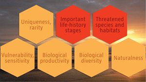
C1: Uniqueness or rarity: Medium
Justification
The mangrove ecosystem of the area, which consists of Rhizophora mangle, Laguncularia racemosa and Avicenna germinans is not represented in mangrove communities elsewhere on the Angolan coast, and their botanical interest alone has been used to justify its conservation (UNEP 2007).
C2: Special importance for life-history stages of species: High
Justification
The Islands of Migratory Birds (Ilhéu dos Pássaros) is internationally recognized as an Important Bird Area – it is a vital feeding and refugee site for large numbers of migrating waterbirds (Birdlife International 2005, 2013). The beaches are used for breeding by globally Vulnerable leatherback turtles as well as Vulnerable olive ridley turtles, which have been found to have high nesting densities at Palmeirinhas by Weir et al. (2007). The densities of nests recorded in Palmeirinhas between 2011 and 2015 were 45 nests.km-1 for the olive ridley turtle nests and 2.6 nests.km-1 for the leatherback turtle (monitored beach 12 km). The area is reported to be an important nursery ground for crabs (Simão pers.comm.). Horse mackerel also spawn in the area, with the eggs and larvae transported offshore to about ‑1300 m. Other studies have suggested that canyons and seamounts can act to aid retention of these products (Rojas & Landaeta, 2014), which is proposed for the adjacent seamounts and shelf-incising canyons in this EBSA.
C3: Importance for threatened, endangered or declining species and/or habitats: High
Justification
The beaches are used for breeding by globally Vulnerable leatherback turtles as well as Vulnerable olive ridley turtles which have high nesting densities at Palmeirinhas (Weir et al. 2007). Threatened bird species Cape gannet Morus capensis and Damara tern Sterna balaenarum are important non-breeding visitors to the inshore area (Birdlife 2005, 2013). The West African manatee Trichechus senegalensis (IUCN Vulnerable) is also reported from this area (Kwanza River) (Morais et al., 2006; da Silva Neto et al. 2007), with the estuarine habitat being considered important for this threatened species (Morais et al., 2006; Powell and Kouadio, 2008).
The BCC spatial assessment (Holness et al., 2014) identified two Critically Endangered ecosystems (Luanda Inshore and Luanda Reflective Sandy Beach), nine Endangered ecosystems (Bengo Shelf, Bengo Shelf Edge, Kwanza Inshore, Kwanza Intermediate Sandy Beach, Kwanza Mixed Shore, Kwanza Shelf, Kwanza Shelf Edge, Luanda Lagoon Coast and Luanda Mixed Shore), and two Vulnerable types (Kwanza Estuarine Shore and Luanda Sheltered Rocky Shore). In the absence of more specific biodiversity information, it can be assumed that these threatened ecosystems support similarly threatened communities of species.
C4: Vulnerability, fragility, sensitivity, or slow recovery: Medium
Justification
The area is key for several relatively long-lived species that reproduce slowly and recover slowly from population declines, such as turtles and manatees (Sarti Martinez 2000, Powell and Kouadio 2008), not to mention mangroves. The mangroves, estuaries and associated low-growing saltmarsh and flat intertidal habitat are all sensitive to anthropogenic pressures such as traffic, pollution, deforestation, development and associated fragmentation, with implications for their function as refugia, breeding or foraging areas. Restoration of degraded mangroves is an extremely complex, costly, long-term process, and hence protection of intact mangroves is a far preferable option. The canyons and seamounts represented in the EBSA are also highly likely to support fragile habitat-forming species such as corals and sponges, as is characteristic of these features.
C5: Biological productivity: Medium
Justification
Mangroves are among the most productive terrestrial ecosystems (FAO 1994) and provide the highly productive coastal lagoons and tidal estuaries with which they are interlinked with essential organic nutrients; they are also critical breeding grounds and nurseries for larval and juvenile stages of important fisheries species (Shumway 1999). The seamounts and canyons may also play a role in enhancing local productivity.
C6: Biological diversity: Medium
Justification
The area contains 23 different habitat types (estuaries, lagoons, mangroves, saltmarshes, flat intertidal habitats, beaches and inshore areas), with associated diversity of species. At least 61 congregatory waterbird species use this area as well as non-breeding waterbird (BirdLife International 2005, 2013), several breeding sea turtle species (Weir et al. 2007), aquatic mammals such as the manatee (da Silva Neto et al. 2007), crabs, shrimps, sea snails and fishes. Field research has confirmed high diversity in this area, although this is still being included in reports.
C7: Naturalness: Medium
Justification
Much of the area is currently relatively pristine but coastal development (BirdLife International 2005) and vehicles in the coastal zone are having some impact in the area. It is also affected by effluent, e.g. from hospitality industry, bungalows, etc, and offshore pressures relate mostly to fisheries. Overall, however, the BCC spatial assessment showed that most of the EBSA area is in a Good (55 %) or Fair condition (32 %; Holness et al., 2014). Nevertheless, the area is likely to be significantly impacted by activities directly adjacent to the EBSA (particularly from Luanda Bay), and this assessment of condition is likely to be highly optimistic.