 |
The proposed Longa Coastline EBSA is in Cuanza-Sul Province in central Angola, and has an approximate area of 470 km2. It includes the Longa River mouth, which comprises a mostly undisturbed, high-energy marine system, with a very well protected lagoon behind a sand dune cordon. This coastal configuration creates a particular suite of abiotic conditions that in turn support a rich diversity of fauna and flora. The site is thus especially important for supporting different life-history stages as well as threatened and declining species and habitats, most notably featuring as the site with the highest nest density for Vulnerable olive ridley turtles. Local insights indicate that the lagoon is an important feature that warrants research to understand its biodiversity patterns, processes, and ecological role, which could benefit from traditional knowledge held by members of the local communities. Many of the biodiversity features comprising the EBSA are sensitive to disturbance, slow growing and/or late maturing (including sea turtles, birds and some species of mangroves). The area is thus highly relevant in terms of the EBSA criteria: “Importance for threatened, endangered or declining species and/or habitats” and “Vulnerability, fragility, sensibility or slow recovery”.
[Top]
Open or collapse the legend as a sidebar by clicking the icon in the top left corner of the map. In the legend you can turn on/off the old/new extents of the EBSA. You can zoom in/out using the mouse or the +/- buttons on the map, and click on the features for more information.
[Top]
NOTE: Read this here, or download the Word document on the right sidebar.
General Information
Summary
The proposed Longa Coastline EBSA is in Cuanza-Sul Province in central Angola, and has an approximate area of 470 km2. It includes the Longa River mouth, which comprises a mostly undisturbed, high-energy marine system, with a very well protected lagoon behind a sand dune cordon. This coastal configuration creates a particular suite of abiotic conditions that in turn support a rich diversity of fauna and flora. The site is thus especially important for supporting different life-history stages as well as threatened and declining species and habitats, most notably featuring as the site with the highest nest density for Vulnerable olive ridley turtles. Local insights indicate that the lagoon is an important feature that warrants research to understand its biodiversity patterns, processes, and ecological role, which could benefit from traditional knowledge held by members of the local communities. Many of the biodiversity features comprising the EBSA are sensitive to disturbance, slow growing and/or late maturing (including sea turtles, birds and some species of mangroves). The area is thus highly relevant in terms of the EBSA criteria: “Importance for threatened, endangered or declining species and/or habitats” and “Vulnerability, fragility, sensibility or slow recovery”.
Introduction
The coastal portion of the Longa River is characterized by an 8-km long dune-backed sandy shore that shelters a narrow estuarine lagoon in the northern half of the central Angolan coast. The estuary mouth itself breaks through the dunes at various locations along this sandy shore; sometimes in the northern portion of the lagoon, and sometimes in the southern portion. The Longa’s waters are dark (almost black) due to leaching tannins. The plume of brackish and nutrient-rich water exiting the estuary mouth moves to the west and north (Morais et al., 2005). The distinct character of this estuarine system is one of the reasons why this area is proposed as an EBSA. However, there is a clear need for more research to better understand the biodiversity patterns, ecological processes and ecological role of the estuarine lagoon system; local knowledge suggests that it is an important feature, but very little is known about it.
What is known, though, is that the estuary is rarely subjected to sudden alterations from estuary-mouth closure, thus allowing mangroves and marginal banks with vegetation to establish within the system (Holísticos, 2014). The vegetation in the surrounds is predominantly made up of dry forest formations, bushy savannah (with Adansonia, Sterculia, Acacia), grassy savannah (of Setaria welwitschii), grassy steppe with shrubs and trees (Hyphaene gossweileri) and palustrine wetlands (Diniz, 2006). The proposed EBSA extends beyond the estuary system itself, and includes approximately 470 km2 (44 km alongshore) of sandy, mixed and rocky shores, and adjacent inshore and estuarine habitats. Most importantly, these beaches support the highest nest densities in Angola for Vulnerable olive ridley turtles. Another species that this site has supported historically is the Vulnerable African manatee. There are no known recent records of this species in Longa River, and so contemporary presence of this species in the Longa Coastline EBSA is not known. Research is required to determine if manatees still exists in the area of if it has been extirpated (and if the latter, why).
The mangroves were fundamental in choosing this site as a proposed EBSA; although not globally significant, these mangroves are of key local significance because they are the southernmost mangroves in Angola. Consequently, the reason this EBSA was not included in the original set of EBSAs at the South Eastern Atlantic Workshop in 2013 (UNEP/CBD/RW/EBSA/SEA/1/4) is because this information was not available at that meeting and local knowledge is better than the information included in international datasets (e.g., WCMC and the World Mangrove Atlas). Further, results from the turtle monitoring programme in the area had not yet been published and thus were not available at the meeting; it was not known at the time how important this site is for these threatened species. Because this is a discrete site that is centred around the mangroves, lagoon and the associated threatened species, it is presented as a Type 1 EBSA (sensu Johnson et al. 2018). It is coastal, and thus does not extend far offshore.
Description of the location
EBSA Region
South-Eastern Atlantic
Location
The proposed area for the Longa Coastline EBSA is located in the province of Cuanza-Sul in central Angola, near the South border of the Quiçama National Park. It includes the Longa River estuary, lagoon and mouth and 44 km of adjacent coastline, covering an approximate area of 470 km2. The whole of the proposed area lies entirely within Angola’s national jurisdiction.
Area Details
Feature description of the area
Longa Coastline is a coastal EBSA is in the province of Cuanza-Sul, Angola, and is thus described primarily for its benthic features, although the overlying water column in the estuary and nearshore is very tightly coupled to the ecology of the site. This proposed EBSA spans the confluence of estuarine and marine systems with specific characteristics. Local knowledge indicates that this estuarine lagoon is an important feature because of the uniqueness of the conditions. However, future research on the lagoon component is required to understand the broader significance of this coastal feature. For example, what other species are present; what is the importance/role of the crocodiles, birds and mangrove species; what are the dynamics of the estuary and the effects during mouth breaching or mouth closure and back flooding? Given the local (human) communities in the surrounding area, traditional knowledge could play an important role in future research projects. For example, as noted below, it is said that local fish catches have declined in recent years: research is necessary to establish why, and how this could potentially be mitigated or reversed, and local fishers’ knowledge could be important in reconstructing past information.
The mangroves, comprising trees and shrubs, are the characteristic vegetation of the area, represented by families of Rhizophoraceae and Avicenniaceae. They provide feeding, breeding, nursery and resting areas for an important component of the local biodiversity. The main indicators of this include a high number of crustaceans (lobsters on the marine side; shrimps and crabs on the estuarine side) as well as many species of fish, among which are representatives of families such as Megalopidae, Carangidae, Lutjanidae, Sciaenidae, Polynemidae, Mugilidae and Clariidae (Holísticos, 2014).
Many bird species use the various ecosystems within the proposed EBSA. Birds rest along the sandy shoreline, nest along the vegetation (mangroves and riparian forest) and move among the local habitats. The most dominant groups are sea swallows and seagulls, some waders, diving birds, aquatic birds and birds of prey (MINAMB et al., 2015). The presence of Asian woolly neck (Ciconia episcopus) was confirmed, which is classified as Vulnerable in accordance with the IUCN Threatened Species Red List (Bird Life International, 2017). This bird is mainly threatened due to hunting by humans and loss of habitat.
The area is seen as the most important site for marine turtles nesting along the Angolan coast. The Kitabanga Project has been ongoing since 2003 in this area and currently monitors around 10 km of beach around the Longa River mouth. It has particularly high nest densities for olive ridley turtles (Lepidochelys olivacea). According to Morais (2014), the Longa region is seen as extremely important for olive ridley turtles, a species classified in the IUCN Red List as Vulnerable, with an average density of 175 nests.km-1. The leatherback turtle (Dermochelys coriacea), classified by the IUCN Red List as Vulnerable, is also present at much lower densities of 2 nests.km-1. However, this region is under high pressure from the artisanal fisheries sector where, during the period of 2013/2014, 136 turtles were captured (Morais, 2014). There are also many other reptile species within the proposed EBSA. Crocodiles, for example, are commonly seen along the river banks and along the whole inner side of the sandy shoreline where they rest and nest (MINAMB et al., 2015).
Among the aquatic mammals, manatees use mostly or exclusively the inshore waters up to estuarine areas from the Longa River to the north, and are seen in some estuaries. However, recent records do not show the presence of manatees in the proposed EBSA. Major threats to this animal’s survival are human exploration (illegal hunting), degradation and/or loss of habitat and accidental capture in nets (Morais et al., 2005), and thus the species is classified as Vulnerable. Further research is required to confirm the presence or extirpation of manatees in this EBSA.
Feature conditions and future outlook of the proposed area
The people living in the surrounding areas come to this site daily in order to carry out commercial activities. The most popular products sold along the road are already made (i.e. meat, fish, and cold beverages) to feed lorry and bus drivers. The residents state that the capture of fish has gone down significantly over the years in terms of volume and occurrence. The environmental conditions of the estuary mouth and the inner side of the estuary are mainly regulated by the river, especially the levels of flood and drought conditions. These are dependent on the rainy season and annual rainfall rate. Beyond the ongoing turtle monitoring, no research is planned for the area, however, it is highlighted here as a priority.
An assessment of ecological condition of the area based on cumulative pressures show that 15 % of the benthic area is in Good condition, and the remaining 85 % is in Fair condition; 100 % of the pelagic area is in Good condition. This suggests that, although there is widespread modification of the area, biodiversity and the ecological processes are still largely intact.
References
Angolan Association of the Oil Exploration and Production Companies (Associação das Companhias de Exploração e Produção de Angola, ACEPA) (2014). Environmental and Social Characterisation to Determine the Coastal Sensitivity of the Areas Between Luanda and Namibe.
BirdLife International. 2017. Ciconia episcopus. (amended version published in 2016) The IUCN Red List of Threatened Species 2017: e.T22727255A110064997. http://dx.doi.org/10.2305/IUCN.UK.2017-1.RLTS.T22727255A110064997.en. Downloaded on 14 December 2017.
FAO (1994). Mangrove forest management guidelines (English) In: Food and Agricultural Organisation (FAO) Forestry Paper, no. 117 / FAO, Rome (Italy). Forest Resources Division, 339 p. http://archive.org/stream/mangroveforestma034845mbp/mangroveforestma034845
mbp djvu.txt (accessed 17 April 2013)
Holísticos (2014). Caracterização Ambiental e Social para o Desenho da Sensibilidade Costeira entre Luanda e Namibe. Relatório Final, Dezembro de 2014.
Holness, S., Kirkman, S., Samaai, T., Wolf, T., Sink, K., Majiedt, P., Nsiangango, S., Kainge, P., Kilongo, K., Kathena, J., Harris, L., Lagabrielle, E., Kirchner, C., Chalmers, R., Lombard, M. 2014. Spatial Biodiversity Assessment and Spatial Management, including Marine Protected Areas. Final report for the Benguela Current Commission project BEH 09-01.
Johnson, D.E., Barrio Froján, C., Turner, P.J., Weaver, P., Gunn, V., Dunn, D.C., Halpin, P., Bax, N.J., Dunstan, P.K., 2018. Reviewing the EBSA process: Improving on success. Marine Policy 88, 75-85.
Morais, M., Torres, M., Martins, M. (2005). Análise da Biodiversidade Marinha e Costeira, e Identificação das Pressões de Origem Humana sobre os Ecossistemas Marinhos e Costeiros (Estudo Temático n.º2 Projecto 00011125 – Estratégia e Plano de Acção Nacionais para a Biodiversidade (NBSAP). Ministério do Urbanismo e Ambiente. Junho 2005
Morais, M. (2014). Relatório de Actividades, Resultados e Gastos Referentes à Temporada 2013/2014 do Projecto Kitabanga - Conservação de Tartarugas Marinhas. Faculdade de Ciências da Universidade Agostinho Neto. Maio 2014.
Morais, M. (2016). Apresentação pública “Projecto Kitabanga - Estudo e Conservação de Tartarugas Marinhas”.
Morais, M. 2004. Informação para a selecção de zonas húmidas e sua classificação como sítios RAMSAR (RIS) em Angola. IUCN ROSA / MINUA. Luanda.
Ministério do Ambiente (MINAMB), Holísticos, C4 EcoSolutions (2015). “Approaching the urgent adaptation needs and reinforcement of the Angolan abilities in regards to climate change” – Description of selected sites: Longa.
Ministério do Urbanismo e Ambiente (MINUA) (2006). Programa de Investimento Ambiental (2006) Relatório do Estado Geral do Ambiente em Angola. Angola.
Shumway, C.A. (1999). Forgotten Waters: Freshwater and Marine Ecosystems in Africa. Strategies for Biodiversity Conservation and Sustainable Development. Available at: http://pdf.usaid.gov/pdf_docs/PNACF449.pdf (accessed 17 April 2013).
Other relevant website address or attached documents
Summary of types of habitats and status of threats for the Longa Coastline. Data from Holness et al. (2014).
|
Threat Status
|
Ecosystem Type
|
Area km2
|
Area (%)
|
|
Endangered
|
Kwanza Exposed Rocky Shore
|
1,9
|
0%
|
|
|
Kwanza Inshore
|
383,6
|
82%
|
|
|
Kwanza Intermediate Sandy Beach
|
3,0
|
1%
|
|
|
Kwanza Mixed Shore
|
45,0
|
10%
|
|
Endangered Total
|
|
433,4
|
92%
|
|
Vulnerable
|
Kwanza Estuarine Shore
|
7,0
|
1%
|
|
Vulnerable Total
|
|
7,0
|
1%
|
|
Least Threatened
|
Kwanza Reflective Sandy Beach
|
11,4
|
2%
|
|
|
Kwanza Sheltered Rocky Shore
|
17,7
|
4%
|
|
Least Threatened Total
|
|
29,1
|
6%
|
|
Grand Total
|
|
469,5
|
100%
|
Status of submission
Area to be submitted to the Conference of the Parties for acknowledgement of meeting EBSA criteria once review process is finalized.
COP Decision
Not yet submitted
Assessment of the area against CBD EBSA criteria
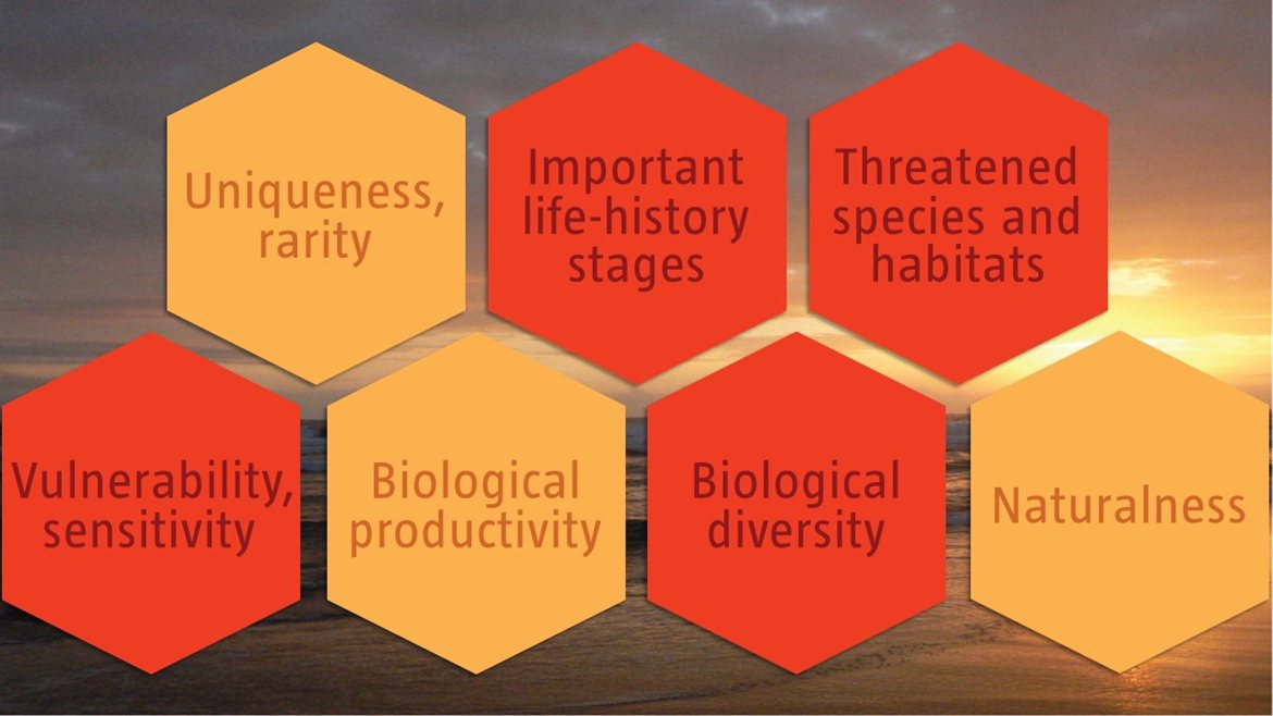
C1: Uniqueness or rarity Medium
Justification
The Longa River mouth is a regionally unique site where there is the combination of a high-energy marine system and a very sheltered estuarine system that jointly created a distinct set of abiotic conditions that support a rich diversity of flora and fauna. It is also one of the most important rookeries in Angola for nesting olive ridley turtles, and the southernmost mangrove community in Angola. Further research is required to fully understand the biodiversity patterns, ecological processes and role of this regionally unique estuarine lagoon system, which may be understated here.
C2: Special importance for life-history stages of species High
Justification
One of the most important attributes of this EBSA is that it is one of the most important turtle rookeries along the Angolan coast. The average nest densities recorded between 2011 and 2015 are as follows: 175 nests.km-1 for the olive ridley turtle (classified as Vulnerable) and 2 nests.km-1 for leatherback turtles (classified as Vulnerable) (Morais, 2016).
The mangroves also offer feeding, breeding, nursery and/or resting sites for many species, including crustaceans, fish and birds. For example, species that use the estuary for breeding and nursery areas include lobsters on the marine side, shrimps and crabs on the estuarine side, and fish from many different families (Holísticos, 2014). The most dominant birds present in the EBSA are sea swallows and seagulls, some waders, diving birds, aquatic birds and birds of prey (MINAMB et al., 2015) that use the site mainly for feeding and resting.
C3: Importance for threatened, endangered or declining species and/or habitats High
Justification
This EBSA is highly important for threatened species, particularly for Vulnerable turtles and manatees. Turtle nesting occurs along the whole strip of sand mainly between September and December, with hatching between October and January. Turtle nesting and hatching in this area is monitored by the Kitabanga Project – Conservation of Marine Turtles. Currently, the project monitors around 10 km of beaches of the Longa River mouth. The average nest density recorded between 2011 and 2015 was 175 nests.km-1 for olive ridley turtles and 2 nests.km-1 for leatherback turtles (Morais, 2016), both of which species are listed as Vulnerable. For this reason, Longa Coastline is of extreme importance for olive ridley turtles because it is the area in Angola that contains the highest nest densities. This is one of the main motivations for this EBSA, and for requiring coastal conservation measures.
The African manatee (Trichechus senegalensis) was, in the recent past, found in this area. However, there are no recent records of manatees in the area. The manatee is a Vulnerable species that is showing declines across its range, and extirpations at some sites due to hunting and habitat destruction (Keith Diagne, 2015). Research is required to determine whether this site still supports manatees, or if it has been extirpated (and if so, why). There are also several threatened bird species in the area, e.g., the Asian woolly neck (Ciconia episcopus), which is classified as Vulnerable. Finally, the proposed EBSA includes various threatened habitats, including four Endangered sandy, rocky and mixed shore types, and one inshore type, and one Vulnerable estuarine shore type.
C4: Vulnerability, fragility, sensitivity, or slow recovery High
Justification
The proposed EBSA comprises several features that are fragile, sensitive to disturbance and that will take a long time to recover. Sensitive species with slow recovery following impacts to populations include the turtles (around 30 years to sexual maturity), manatees (30-year generation time) and some of the birds. The mangroves are the most sensitive ecosystem in the proposed EBSA because the trees are slow growing. Research is required to determine the vulnerability and sensitivity of the estuarine lagoon system.
C5: Biological productivity Medium
Justification
No data exist for this particular system; however it is known that mangroves are among the most productive ecosystems (FAO 1994), in turn supporting highly productive coastal lagoons and estuaries that contain essential organic nutrients. Mangroves are also important fish spawning sites and nursery areas for larvae and juvenile stages of important species (Shumway, 1999), with lobsters and shrimps of importance in the Longa River.
C6: Biological diversity High
Justification
All habitats in this site present a set of favorable conditions for a rich diversity of species, from plants to iconic vertebrates. The high diversity of plant species at this site comes from the combination of dune, mangrove and forest areas in the proposed EBSA that each support different floral communities. Similarly, habitat diversity contributes to diverse animal species assemblages, with a high number of crustaceans (i.e., lobsters in the marine shore and shrimps and crabs in the estuarine shore) and many species of fish (namely Megalopidae, Carangidae, Lutjanidae, Sciaenidae, Polynemidae, Mugilidae and Clariidae families) (Holísticos, 2014). The most dominant groups of birds include sea swallows and seagulls, some waders, diving birds, aquatic birds and birds of prey (MINAMB et al., 2015). Crocodiles are frequently observed resting and nesting along the riverside and on the inner side of the sandy riverbank (MINAMB et al., 2015), with other repties including several species of turtles, some of which nest on the site’s beaches. Manatees were historically present at this site too, but it is not clear if this is still the case.
C7: Naturalness Medium
Justification
An assessment of ecological condition of the area based on cumulative pressures show that 15 % of the benthic area is in Good ecological condition, and the remaining 85 % is in Fair ecological condition; 100 % of the pelagic area is in Good ecological condition. This suggests that, although there is widespread modification of the area, biodiversity and the ecological processes are still largely intact.
Some important areas of mangrove and the riparian vegetation around the River Mouth are in pristine condition with little signs of human intervention or global degradation. It is estimated that the size of this area is 30 ha (MINAMB et al., 2015). However, outside of this area some impact result from activities of the community along this road who moves daily to this area to carry out commercial activities. The residents state that the capture of fish has gone down significantly over the years in terms of volume and occurrence. The environmental conditions of the river mouth and the inner side of the estuary are mainly regulated by associated riverside factors, especially the levels of flooding and drought conditions.