 |
The Ponta Padrao Mangroves and Turtle Beaches on the Sereia Peninsula is located in Soyo, at the Congo River mouth in northern Zaire, Angola. The proposed area consists of 17 km of coastline and some of the most important mangroves in Angola associated with the Congo River. There is a network of canals and coves that link to the bay, the most noteworthy being the Pululu, Moita Seca and Soyo Canals, which are largely covered by mangrove forest. It has a particularly rich diversity of plants, birds, mammals, reptiles, fish and invertebrates from both the terrestrial and marine realms, most significantly providing critical habitat for Vulnerable manatees (which are facing local extirpations due to hunting and habitat degradation) and Vulnerable nesting turtles. The ecosystem shows some degree of anthropogenic degradation from construction of new artificial canals, mangrove logging, and coastal development. Several species (including manatees, turtles, birds, mangroves and dunes) are sensitive to disturbance, and have slow growth and/or reproduction rates. The area is thus highly relevant in terms of the EBSA criteria: “Importance for threatened, endangered or declining species and/or habitats” and also “Vulnerability, fragility, sensibility or slow recovery”, and “Biological Diversity”.
[Top]
Open or collapse the legend as a sidebar by clicking the icon in the top left corner of the map. In the legend you can turn on/off the old/new extents of the EBSA. You can zoom in/out using the mouse or the +/- buttons on the map, and click on the features for more information.
[Top]
NOTE: Read this here, or download the Word document on the right sidebar.
General Information
Summary
The Ponta Padrao Mangroves and Turtle Beaches on the Sereia Peninsula is located in Soyo, at the Congo River mouth in northern Zaire, Angola. The proposed area consists of 17 km of coastline and some of the most important mangroves in Angola associated with the Congo River. There is a network of canals and coves that link to the bay, the most noteworthy being the Pululu, Moita Seca and Soyo Canals, which are largely covered by mangrove forest. It has a particularly rich diversity of plants, birds, mammals, reptiles, fish and invertebrates from both the terrestrial and marine realms, most significantly providing critical habitat for Vulnerable manatees (which are facing local extirpations due to hunting and habitat degradation) and Vulnerable nesting turtles. The ecosystem shows some degree of anthropogenic degradation from construction of new artificial canals, mangrove logging, and coastal development. Several species (including manatees, turtles, birds, mangroves and dunes) are sensitive to disturbance, and have slow growth and/or reproduction rates. The area is thus highly relevant in terms of the EBSA criteria: “Importance for threatened, endangered or declining species and/or habitats” and also “Vulnerability, fragility, sensibility or slow recovery”, and “Biological Diversity”.
Introduction of the area
The Ponta Padrao Mangroves and Turtle Beaches on the Sereia Peninsula, in Soyo, which is along the northern border of Angola’s Zaire Province at the Congo River mouth. It falls in the savannah forest and Angolan woods ecoregion that is composed of palm trees, forest remnants, bush, mangroves and coastal areas. The coastal influences are key to the formation of the Sereia Peninsula, which in turn is fundamental to the maintenance of the estuarine character of Diogo Cão Bay (ERM, 2006a). The Sereia Peninsula has tree- and shrub-form mangroves that serve as a shelter for bird and turtle nests, as well as fulfilling other ecological roles. Apart from the widely distributed and sensitive mangrove habitats, there is a unique area comprising remnants of Atlantic forest that is important in terms of biodiversity. In fact, it represents the last large area of this type in the region (ERM, 2006b).
The zonation of the Sereia mangroves differs from the general zonation of the West African mangrove communities, as described by Chapman (1976), Tomlinson (1986) and Saenger and Bellan (1995). The sandy soil plays a major role in the system laying down fine materials, clay and limos, in the mangroves or near to it. It is confined to the Moita Seca Canal, some sites of the Pululu Canal and is prevalent near Diogo Cão Bay. These locations are clearly identified by the presence of tall mangrove forms. In most other similar sites in West Africa, sandy sediments are colonized by Avicennia germinans, although R. racemosa may act as the pioneer of low-salinity sands (Lebigre, 1983). Bottom sediments along the outer side of Diogo Cão Bay and along the transport canal to the Base of Kwanda have high concentrations of mud (20-95%), while equivalent sediments of the Base of Kwanda up to the furthest points of the Pululu canal are predominantly sand (CSIR, 2003b; Herod, 2003). The Sereia Peninsula mangroves together with the mangroves in the south of the Kwanda Base occupy approximately 39 km2. This is relatively small (8 %) in comparison to the broader distribution of mangroves (i.e., in the estuary of the Congo River as a whole), but locally it represents a significant habitat (ENSR, 2005). The mangroves contribute vast amounts of organic carbon to the waterbody of the estuary in the way of leaves, debris and dissolved materials (ERM, 2006a), which elevates the local productivity.
A critical feature of the site is the beaches that line the mangroves. The nearly the full spectrum of beach morphodynamic types is represented, from reflective to dissipative-intermediate types, with the bulk being intermediate. These beaches provide excellent habitat for turtles to nest, particularly for olive ridleys, although green turtles and leatherbacks are also present in the area, with the former recorded nesting there too, recognizing that only a 15 km section is monitored, and local nest densities may be higher than currently reported.
The mangroves and riverine forest associated with the river were fundamental in choosing this site as a proposed EBSA; although not globally significant, these mangroves are of key local significance. Consequently, the reason this EBSA was not included in the original set of EBSAs at the South Eastern Atlantic Workshop in 2013 (UNEP/CBD/RW/EBSA/SEA/1/4) is because this local knowledge was not available at that meeting and is better than the information included in international datasets (e.g., WCMC and the World Mangrove Atlas). Further, the turtle monitoring programme in the area had barely started at the time of the first workshop, and again, the nest data that were just starting to be collected were not available at that meeting; it was not known at the time how important this site is for these threatened species. Because this is a discrete site that is centred around the mangroves and its associated threatened species, it is a Type 1 EBSA (sensu Johnson et al. 2018).
Description of the location
EBSA Region
South-Eastern Atlantic
Description of location
The Ponta Padrao Mangroves and Turtle Beaches on the Sereia Peninsula is a coastal area located in the town of Soyo, in the extreme north of the Zaire province and bordering the Congo River mouth. The proposed area comprises approximately 50 km2 and 17 km of coastline. The whole of the proposed area lies entirely within Angola’s national jurisdiction.
Area Details
Feature description of the area
Ponta Padrao Mangroves and Turtle Beaches is a coastal EBSA and is thus described primarily for its benthic features, although the overlying water column in the estuary, surf and nearshore is tightly coupled to the key features and species at this site. The mangroves in the study area are part of the East Atlantic forest, and indigenous knowledge indicates that these mangroves around the Congo River mouth are some of the most important mangroves in Angola. The EBSA comprises tree- and shrub-form mangroves of two main species: Rhizophora racemosa and R. harrisonii, with R. mangle also present but less abundant. Mangroves made up of the African Rhizophora are very tolerant to fresh water (Saenger & Bellan, 1995; Lebigre, 1983, 1999) but may also survive under high salinity levels for at least part of the year. This is consistent with observations of the mangroves in this area; they are almost exclusively fresh water in some places and dominated by R. racemosa and R. harrisoni. In some places, the transitional mangroves have a terrestrial component whose characteristic species are ferns Bolbitis auriculata and the thorny shrub Drepanocarpus lunatus (CSIR, 2005c).
Plant diversity at the site extends to the adjacent forest and dunes as well. The only area of true forest in the EBSA occurs in the Sereia Forest. It covers an area of approximately 4 ha (ERM, 2006). The species of forest trees generally include a variety of fig species, African nutmeg (Pycanthus kombo) and woody species such as Entandrophragma angolensis. It is likely that there is an important component of shrubs and numerous lianas (ERM, 2006a). Although forests are terrestrial systems, they are included in this EBSA because they are interspersed with canals and tributaries that define the extent of the mangroves and other strongly coast-associated features. Similarly, the dunes behind the turtle nesting beaches are a key component of the coastal system because the critical linkages between beaches and dunes are important to maintain to secure resilience of sandy shores in the face of global change, and especially sea-level rise. The dune vegetation of the coastline is dominated by pioneering species. This flora is typical of the Central and West African coast (Lebrun, 1954; Davies and Le Maitre, 2003; CSIR, 2003a), comprising of a variety of herbs (Sesuvium crystallinum, Ipomoea pes-caprae, Canavallia obtusifolia), grasses (Sporobolus virginicus, Eragrostis linearis, etc.) and shrubs (Scaevola plumieri and Chrysobalanus icaco) (ERM, 2006a).
Bird diversity is also rich, including resident, migrating, visiting, and seasonal birds that use the area as a resting and feeding place. The mangroves of Soyo have similar bird communities to the mangroves of the Park des Mangroves in the Democratic Republic of Congo (DRC), which is a designated Ramsar site. Coastal birds found in the area include Phalaropus fulicarius, Larus fuscus, Larus dominicanus, Sterna albifrons and S. maxima (Dean, 2000; Dowsett and Simpson, 1991; Urban et al., 1986). Birds that feed on fish are uncommon within Diogo Cão Bay, although certain species of birds such as the Ceryle maxima, H. chelicuti and H. senegalensis, wader birds and bigger aquatic birds such as Cape cormorants (Phalacrocorax capensis) and small and great white egrets (Egretta alba and E. garzetta) use the margins of the mangrove canals as feeding grounds. The palm-nut vulture (Gypohierax angolensis) and the African fish eagle (Haliaeetus vocifer) are commonly seen over the river-mouth waters and the former over the palm tree savannah as well. A series of threatened and endemic species were identified in Angola, although only some of them exist in the area because there is not enough adequate habitat to support them.
Given the diverse habitats in the area, the EBSA also supports a variety of mammal species. In terms of terrestrial mammals, notable species are the side-striped jackal and wildcat. Marine mammals include cetaceans such as the blue whale, Rorquais, common dolphin and spotted dolphin that are found along the whole of the Angolan coastline. Perhaps most important of all, this site seems to be especially significant for Vulnerable manatees, with these mammals being reported as common in the Congo River (Keith Diagne, 2015). Manatees are in a general state of population decline, with local extirpations reported across its range due to hunting and habitat destruction (Keith Diagne, 2015), making sites where these animals are abundant even more important. Manatees have been hunted in the Congo River, with one hunter noting that he had killed three manatees per week for 30 years (Keith Diagne, 2015). However, current data on the abundance of manatees are limited.
The local reptiles include snakes and marine turtles that nest in the region. Up to five species of turtles (all of which are listed by the IUCN as threatened) use the Atlantic beach in the southeast of Ponta do Padrão as a nesting place (ENSR, 2005), although the site is primarily recognized as a rookery for Vulnerable olive ridley turtles. There are no records of nests in the inner coastline (to the east) of the Peninsula within Diogo Cão Bay, possibly due to high levels of human activity and low salinity (CSIR, 2005). The Kitabanga Project for conservation of marine turtles that was set up in 2003 currently monitors approximately 15 km of the beach of Soyo. The densities of nests recorded between 2011 and 2015 were as follows: 61 nests.km-1 for olive ridley turtles, 0.2 nests.km-1 for green turtles, and no records for leatherback turtles.
The diversity of marine and freshwater fish species is also particularly high. The following commercial species of fish predominate: corvina, sardines, grouper, saw fish, snapper, hammer shark, flounder, stingray, bagre, barracuda, red snapper, grey reef sharks, twaite shad, big eyed haemulidae, beltfish, mullets, and Guinea corvina (ACEPA, 2012). Many of these fish rely on the local zooplankton, which are abundant in the EBSA. There are many invertebrates in the area, including crabs, snails, oysters and shrimps, although the latter are commercially over-exploited. Despite the significant organic flow to Diogo Cão Bay originating from the mangrove and aquatic vegetation, the available data suggest that the benthos is actually impoverished (CSIR, 2005). Within the mangrove margins, macrofauna is limited to mudskippers (Periopthalmus sp) and mangrove crabs (Sesarma sp).
Feature conditions and future outlook of the proposed area
The lack of basic infrastructure surrounding the area, such as drinking water, electricity and access roads, makes establishing private settlements in the vicinity very unlikely. However, tourists who come to see the classified historical monument, Ponta do Padrão, do occasionally visit the beach. Overall, however, the site is in good to fair ecological condition based on an assessment of cumulative pressures.
References
Angola LNG ESHIA Addendum Report October 2009.
Angola Resources Consultants (ARC), 2013. Estudo de Impacte Ambiental Social e da Saúde do Projecto de Desenvolvimento do Pólo Oeste no Bloco 15/06, Zaire Angola. Maio 2013.
Chapman, V.J. (1976). Mangrove Vegetation. Vaduz: J Cramer.
Checklist Ministério do Ambiente (MINAMB), Holísticos, C4 EcoSolutions (2015). “Approaching the urgent adaptation needs and reinforcement of the Angolan abilities in regards to climate change” – Description of selected sites: Zaire-Soyo.
CSIR (2003) - Angola LNG Project, Phase 4: Qualitative EIA: Impacts of Site development options on mangroves and related ecosystems (Preliminary Report).
CSIR 2003a. Cameroon National Oil Spill Contingency plan (Draft). February 2003. CSIR Report No. ENVS-C 2003-008.Environmentek, CSIR, Stellenbosch.
CSIR 2003b. Supplemental Data Acquisition Program for Angola LNG Project Site Selection – Phase 2: Preliminary London Convention Compliance Assessment. Report prepared for Texaco Angola Natural Gas Inc. CSIR Report No. ENV-S-C 2003-100C. Environmentek, CSIR, Stellenbosch.
CSIR (2003c) Angola LNG Project – Environmental Due Diligence and Geotechnical Evaluation: Soyo Site. Report prepared for Texaco Angola Natural Gas Inc. CSIR Report No ENV-S-C 2003-063.
CSIR (2005) Angola LNG Project: Environmental, socioeconomic and Health Impact Assessment: Sediment and Water Quality. CSIR Report (in prep).
Dar Al-Handasah (1999) Programma de Desenvolvimento Urbano e Socio Económico. Sumário Executivo.
Davies, S.J. and Le Maitre, D.C., 2003. Peninsula Mussulo Masterplan: Ecological Sensitivity Analysis. CSIR Report No: ENV-S-C 2002-091. CSIR-Environmentek, Stellenbosch, South Africa. Prepared for Africon, South Africa.
Dean, W.R.J. (2000) The birds of Angola. BOU Checklist Series 18 British Ornithological Union, Tring, Herts, Engalnd 433pp.
Dowsett, R.J. and Simpson, R.D.H (1991) The status of seabirds off the coast of Congo. In: Dowsett, RJ and Dowsett-Lemaire, F (eds.) Flora and fauna of the Kouilou Basin (Congo) and their exploitation Tauraco Research Report 4: 241-250.
ENSR International (2005). Scoping Phase Supporting Document for the Angola LNG Project, Proposed Angola LNG Project Environmental, Socioeconomic, and Health Impact Assessment (ESHIA), Março 2005.
ERM (2006a). Angola LNG Environmental, Social and Health Impact Assessment (unpublished).
ERM (2006b). Projecto Angola LNG, Relatório para Divulgação do ESHIA, Sumário Executivo. 2006.
Herod, J., 2003. Trip Report - Visit to Dredging International, Antwerp, Belgium. Copy supplied by John Herod, ChevronTexaco.
Holísticos (2013). Caracterização Ambiental e Social para o Desenho da Sensibilidade Costeira entre Cabinda e Kwanza Sul (Quicombo). Relatório Final, Maio, 2012.
Holness, S., Kirkman, S., Samaai, T., Wolf, T., Sink, K., Majiedt, P., Nsiangango, S., Kainge, P., Kilongo, K., Kathena, J., Harris, L., Lagabrielle, E., Kirchner, C., Chalmers, R., Lombard, M. 2014. Spatial Biodiversity Assessment and Spatial Management, including Marine Protected Areas. Final report for the Benguela Current Commission project BEH 09-01.
Johnson, D.E., Barrio Froján, C., Turner, P.J., Weaver, P., Gunn, V., Dunn, D.C., Halpin, P., Bax, N.J., Dunstan, P.K., 2018. Reviewing the EBSA process: Improving on success. Marine Policy 88, 75-85.
Lebigre, J-M., 1983. Le mangroves des rias du littoral Gabonais. Essai de cartographie typologique. Revue des Bois et Fôret des Tropiques 199: 3-27.
Lebigre, J-M., 1999. Natural dynamics of mangals through their margins: diagnostic elements. Hydrobiologia 413: 103-113.
Lebrun, J., 1954. Sur la végétation du secteur littoral du Congo Belge. Vegetation 5-6: 157-160.
Morais, M., Torres, M., Martins, M. (2005). Análise da Biodiversidade Marinha e Costeira, e Identificação das Pressões de Origem Humana sobre os Ecossistemas Marinhos e Costeiros. Estudo Temático n.º2. Projecto 00011125, Estratégia e Plano de Acção Nacionais para a Biodiversidade (NBSAP). Ministério do Urbanismo e Ambiente, Junho de 2005.
Morais, Michel. 2016. Apresentação pública “Projecto Kitabanga - Estudo e Conservação de Tartarugas Marinhas”.
Saenger, P. and Bellan, M.F., 1995. The mangrove vegetation of the Atlantic coast of Africa. A review. Laboratoire d’Ecolgie Terrestre (UMR 9964), Centre Nationale De La Recherche Scientifique, Universite de Toulouse III, France.
Shumway, C.A. 1999. Forgotten Waters: Freshwater and Marine Ecosystems in Africa. Strategies for Biodiversity Conservation and Sustainable Development.
http://pdf.usaid.gov/pdf_docs/PNACF449.pdf (accessed 17 April 2013).
Tomlinson, P.B., 1986. The Botany of Mangroves. Cambridge University Press, Cambridge.
Urban, E.K., Fry, C.H. and Keith, S. (eds.) (1986) The Birds of Africa Vol. 2. Academic Press, London.
Other relevant website address or attached documents
Summary of types of habitats and status of threats for the Sereia Peninsula. Soyo-Zaire. Data from Holness et al. (2014).
|
Threat Status
|
Ecosystem Type
|
Area km2
|
Area (%)
|
|
Critically Endangered
|
Congo Intermediate Sandy Beach
|
4,9
|
10%
|
|
Critically Endangered Total
|
|
4,9
|
10%
|
|
Endangered
|
Congo Inshore
|
0,3
|
1%
|
|
Endangered Total
|
|
0,3
|
1%
|
|
Vulnerable
|
Congo Dissipative-Intermediate Sandy Beach
|
0,4
|
1%
|
|
Vulnerable Total
|
|
0,4
|
1%
|
|
Least Threatened
|
Congo Estuarine Shore
|
41,5
|
83%
|
|
|
Congo Reflective Sandy Beach
|
3,0
|
6%
|
|
Least Threatened Total
|
|
44,5
|
89%
|
|
Grand Total
|
|
50,1
|
100%
|
Status of submission
Area to be submitted to the Conference of the Parties for acknowledgement of meeting EBSA criteria once review process is finalized.
COP Decision
Not yet submitted
Assessment of the area against CBD EBSA criteria
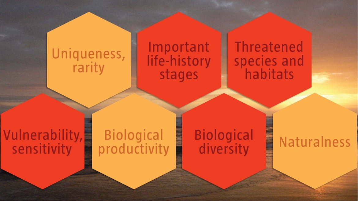
C1: Uniqueness or rarity Medium
Justification
Apart from largely distributed habitats of sensitive mangrove, there is only a single area of remnants of important Atlantic forest in terms of biodiversity, which represents the very last area of this kind of habitat in the region.
C2: Special importance for life-history stages of species High
Justification
Turtle nesting occurs on the Atlantic beaches along the whole peninsula. It is also a nesting and breeding site for many bird species and a feeding and resting place of many other species. The vast mangroves are of extreme importance for fish reproduction in the Congo River mouth. The calm waters of the mangrove forest act as nurseries for juvenile fish and shrimps and the aerial roots, low-level logs and the mud surfaces generally support a varied fauna of oysters, snails, crabs and other invertebrates (Morais et al., 2005).
C3: Importance for threatened, endangered or declining species and/or habitats High
Justification
Most importantly, this area supports many threatened species, notably turtles, manatees, and birds. The Kitabanga Project is a marine turtle conservation program that was set up in 2003. It currently monitors approximately 15 km of the Soyo beaches. Densities of turtle nests recorded between 2011 and 2015 are as follows: 61 nests.km-1 for Vulnerable olive ridley turtles, 0.2 nests.km-1 for Endangered green turtles and no records for the Vulnerable leatherback turtle (Morais, 2016). The Congo River is also a site where Vulnerable manatees are commonly found. African manatees are in a general state of population decline, with local extirpations reported across its range due to hunting and habitat destruction (Keith Diagne, 2015), making sites where these animals are abundant even more important. Manatees have been hunted in the Congo River, with one hunter noting that he had killed three manatees per week for 30 years (Keith Diagne, 2015), which is more than 4500 animals. However, current data on the abundance of manatees are limited. There are also several threatened bird species that use the site as a nesting, breeding, foraging and resting site.
In terms of habitats, there is only one area where remnants of the important Atlantic forest remain; thus, the proposed EBSA contains the very last area of this kind of habitat in the region. It also contains Critically Endangered and Vulnerable sandy beach types, and an Endangered inshore ecosystem.
C4: Vulnerability, fragility, sensitivity, or slow recovery High
Justification
The proposed EBSA comprises several features that are fragile, sensitive to disturbance and that will take a long time to recover. The mangroves are the most sensitive ecosystem in the proposed EBSA. Sensitive species with slow recovery following impacts to populations include the turtles (around 30 years to sexual maturity), manatees (30-year generation time) and some of the birds. Further, although beaches are largely resilient ecosystems, the adjacent dune systems are very sensitive to disturbance, and the more mature dune forests can take centuries to recover from disturbance.
C5: Biological productivity Medium
Justification
Mangroves are among the most productive ecosystems (FAO 1994) and provide coastal lagoons and estuaries with essential organic nutrients. Mangroves are also an important breeding and nursery area for larvae and important species in juvenile stages, especially for the fish and crustaceans in this area (Shumway, 1999).
C6: Biological diversity High
Justification
The diversity of habitats on the peninsula provide favorable conditions for many species from the marine, coastal, estuarine and terrestrial realms to occur. The site supports particularly diverse assemblages of birds, fish, turtles, invertebrates, small mammals, and snakes. For example, bird species include resident, migrating, visiting, and seasonal birds that comprise similar communities to those at Park des Mangroves in the Democratic Republic of Congo (DRC), which is a designated Ramsar site. The mammals include terrestrial species, such as jackals and wildcats, and marine species, such as a variety of dolphins and whales, and importantly, manatees. Reptiles similarly include terrestrial and marine representatives, including snakes and sea turtles. Both marine and freshwater fish are present, with species ranging from teleost fish to sharks and stingrays. Invertebrates are also diverse, including some commercially important species, such as shrimp.
The plant diversity is particularly notable, with the combination of dune, mangrove and forest species represented in the area, over and above the likely rich communities of microflora that are associated with the high organic loads from the mangroves.
C7: Naturalness Medium
Justification
The ecosystem shows some degree of anthropogenic degradation caused by existent populations as well as by the setting up of new artificial canals, mangrove wood cutting and the presence of communities. An assessment of ecological condition of the area based on cumulative pressures show that 15 % of the benthic area is in good condition, and the remaining 85 % is in fair condition; 100 % of the pelagic area is in Good condition. This suggests that, although there is widespread modification of the area, biodiversity and the ecological processes are still largely intact.