Protea Banks and Sardine Route is a coastal EBSA that includes a key component of the migration path for several fish (known as the sardine run) and an offshore area of high habitat complexity. Benthic features include a unique deep-reef system known as Protea Banks, steep shelf edge and slope, and several submarine canyons. The sardine run is a temporary feature associated with foraging top predators, including seabirds, mammals, sharks and gamefish. Protea Banks is also an aggregating area, with spawning of sciaenids and sparids reported. Some of these species are in decline and are considered threatened. This area has moderate productivity, and the sardine run represents an important ecological process that facilitates the transfer of nutrients from the more productive Agulhas Bank into the more oligotrophic environment further north. This EBSA includes five existing coastal MPAs, two of which were expanded to improve protection of key marine biodiversity assets.
[Top]
Open or collapse the legend as a sidebar by clicking the icon in the top left corner of the map. In the legend you can turn on/off the old/new extents of the EBSA. You can zoom in/out using the mouse or the +/- buttons on the map, and click on the features for more information.
[Top]
Boundary revised, description and criteria ranks updated.
[Top]
NOTE: Read this here, or download the Word document on the right sidebar.
General Information
Summary
Protea Banks and Sardine Route is a coastal EBSA that includes a key component of the migration path for several fish (known as the sardine run) and an offshore area of high habitat complexity. Benthic features include a unique deep-reef system known as Protea Banks, steep shelf edge and slope, and several submarine canyons. The sardine run is a temporary feature associated with foraging top predators, including seabirds, mammals, sharks and gamefish. Protea Banks is also an aggregating area, with spawning of sciaenids and sparids reported. Some of these species are in decline and are considered threatened. This area has moderate productivity, and the sardine run represents an important ecological process that facilitates the transfer of nutrients from the more productive Agulhas Bank into the more oligotrophic environment further north. This EBSA includes five existing coastal MPAs, two of which were expanded to improve protection of key marine biodiversity assets.
Introduction of the area
The Protea Banks and Sardine Route includes a key component of the migration path for several fish (known as the sardine run) and an offshore area of high habitat complexity. Benthic features include a unique deep reef system known as Protea Banks, steep shelf edge and slope, and several canyons. Protea Banks comprises a relatively shallow “seamount” that drops to extensive rocky flats that extend towards the shelf edge (the full extent of which is currently uncertain). Diversity is high in this area, with 40 ecosystem types represented in the EBSA, 20 of which are threatened and a further seven are Near Threatened. It constitutes a site of fish spawning aggregations and is home to an abundance of soft corals, algae and molluscs, many of which are endemic. The area includes benthic and pelagic features, with further details on habitats, processes and species detailed in Mann (2000), Freon et al. (2010), Sink et al. (2011), Harris et al. (2011) and Ezemvelo KZN Wildlife (2012). The sardine run is an annual, temporary feature usually associated with foraging top predators, including seabirds, mammals (O’Donoghue et al., 2010a, 2010b), sharks and gamefish (Dudley and Cliff 2010, Fennessy et al., 2010).
Description of the location
EBSA Region
Southern Indian Ocean
Description of location
Protea Banks and Sardine Route is a coastal EBSA, entirely with the South African EEZ. Alongshore, it extends from the Aliwal Shoal MPA in the north, to the Dwesa-Cwebe MPA in the south. Although it extends only 25-35 km offshore from the dune base across most of the EBSA, it covers a vast depth range because the continental shelf is so narrow in this area. Most of Protea Banks and Sardine Route extends from 0 m to -1800 m or deeper.
Geo-Location
SIO_4_EBSA.geojson
Area Details
Feature description of the area
This area includes benthic and pelagic features, with details on habitats, processes and species in Mann (2000), Freon et al., (2010), Sink et al., (2011), Harris et al., (2011) and Ezemvelo KZN Wildlife (2012). The EBSA includes 40 ecosystem types, seven of which are Endangered, 13 are Vulnerable and a further seven are Near Threatened (Sink et al., 2019). This spans a rich diversity of types, including a variety of shore types (including estuarine shores), reefs, unconsolidated-sediment benthic types, slope types and canyons (Sink et al., 2019). The area includes part of a key migration pathway (known as the sardine run) that is an important ecological process believed to play a role in the transfer of productivity from the productive Agulhas Bank into the less productive area in southern KwaZulu-Natal. Some research has been conducted on the sardine migration (see Freon et al., 2010, Van der Lingen et al., 2010) but the heterogeneous benthic habitats in deep water are poorly studied. Key habitats include a unique deep-reef feature, submarine canyons (with seven reef-building cold-water coral records, representing three different species, in the national invertebrate museum collection), hard shelf edge and unconsolidated shelf and shelf edge sediments. In situ research is needed in the deeper areas of this EBSA.
There has been new research in the area since the EBSA was first proposed, which has contributed significantly to identifying the features that are present, their extent and importance. The boundary of this EBSA was also refined to align with initiatives to expand South Africa’s MPA network, and better represent the underlying features comprising the EBSA to improve precision in the delineation. This was based on the best available data (e.g., GEBCO Compilation Group 2019; Harris et al., 2014; Holness et al., 2014; Majiedt et al., 2013; Sink et al., 2012, 2019). New fine-scale mapping of the coast (Harris et al., 2019) also allowed a more accurate coastal boundary to be delineated. It is presented as a Type 2/4 EBSA (sensu Johnson et al., 2018) for containing “spatially stable features whose individual positions are known, but a number of individual cases are being grouped” and “features that are inherently not spatially fixed. The position of this feature moves seasonally and among years.”. The benthic features (e.g., reefs and canyons) are spatially fixed and grouped, and the sardine run is a seasonal phenomenon that occurs in the same area, but the exact position is variable across years.
Feature conditions and future outlook of the proposed area
South Africa’s National Biodiversity Assessment 2011, 2018 (Sink et al., 2012, 2019) indicated declining conditions in the original delineation (based on pressure data and an ecosystem-pressure matrix), with conditions ranging from fair to poor. In an updated assessment, and in the new delineation, cumulative pressure was moderate across the EBSA overall; however, cumulative pressure in the northern portion and along the coast is high (Sink et al., 2019). There are five existing MPAs in this EBSA, some of which have moderate to high cumulative pressure within them. Protection of biodiversity assets in this EBSA will be strengthened since the recent, notable expansion of two of the existing reserves. Fish species in the area include threatened or depleted species. There is planned research in the Protea Banks area through the African Coelacanth Ecosystem Program Phase III.
References
References
BirdLife International, 2009. Designing networks of marine protected areas: exploring the linkages between Important Bird Areas and ecologically or biologically significant marine areas. Cambridge, UK: BirdLife International. www.cbd.int/doc/meetings/mar/ewbcsima-01/other/ewbcsima-01-birdlife-02-en.pdf
BirdLife International, 2010. Marine Important Bird Areas toolkit: standardised techniques for identifying priority sites for the conservation of seabirds at-sea. BirdLife International, Cambridge UK. Version 1.1: May 2010. www.birdlife.org/eu/pdfs/Marine_IBA_Toolkit_2010.pdf
De Clerck, O., Bolton, J.J., Anderson, R.J., Coppejans, E. 2005. Guide to the seaweeds of KwaZulu-Natal. Scripta Botanica Belgica Vol.33. Meise: National Botanic Garden of Belgium.
Ezemvelo KZN Wildlife, 2012. Focus areas for additional marine biodiversity protection in KwaZulu-Natal, South Africa. Unpublished Report - Jan 2012. Scientific Services, Ezemvelo KZN Wildlife: Durban. Pp 62.
Fréon, P., Coetzee, J.C., van der Lingen, C.D., Connell, A.D., O’Donoghue, S.H., Roberts, M.J., Demarcq, H., Attwood, C.G., Lamberth, S.J., Hutchings, L. 2010. Review and tests of hypotheses about causes of the KwaZulu-Natal sardine run. African Journal of Marine Science, 32: 449–479.
Johnson, D.E., Barrio Froján, C., Turner, P.J., Weaver, P., Gunn, V., Dunn, D.C., Halpin, P., Bax, N.J., Dunstan, P.K., 2018. Reviewing the EBSA process: Improving on success. Marine Policy 88, 75-85.
O’Donoghue, S.H., Drapeau, L., Peddemors, V.M. 2010a. Broad-scale distribution patterns of sardine and their predators in relation to remotely sensed environmental conditions during the KwaZulu- Natal sardine run. African Journal of Marine Science, 32: 279–291.
O’Donoghue, S.H., Whittington, P.A., Peddemors, V.M,. Dyer, B.M. 2010b. Abundance and distribution of avian and marine mammal predators of sardine observed during the 2005 KwaZulu-Natal sardine run survey. African Journal of Marine Science, 32: 361–374.
O’Donoghue, S.H., Drapeau, L., Dudley, S.F.J., Peddemors, V.M. 2010c. The KwaZulu-Natal sardine run: shoal distribution in relation to nearshore environmental conditions, 1997–2007. African Journal of Marine Science, 32: 293–307.
GEBCO Compilation Group, 2019. GEBCO 2019 Grid (doi:10.5285/836f016a-33be-6ddc-e053-6c86abc0788e)
Fennessey, S.T., Pradervand, P., De Bryn P. 2010. Influence of the sardine run on selected nearshore predatory teleosts in KwaZulu-Natal. African Journal of Marine Science, 32: 375- 382.
Harris, J.M., Livingstone, T., Lombard, A.T., Lagabrielle, E., Haupt, P., Sink, K., Mann, B., Schleyer, M. 2011. Marine Systematic Conservation Assessment and Plan for KwaZulu-Natal - Spatial priorities for conservation of marine and coastal biodiversity in KwaZulu-Natal. Ezemvelo KZN Wildlife.
Harris, L.R., Bessinger, M., Dayaram, A., Holness, S., Kirkman, S., Livingstone, T.-C., Lombard, A.T., Lück-Vogel, M., Pfaff, M., Sink, K.J., Skowno, A.L., Van Niekerk, L., 2019. Advancing land-sea integration for ecologically meaningful coastal conservation and management. Biological Conservation 237, 81-89.
Harris, L.R., Nel, R., Oosthuizen, H., Meyer, M., Kotze, D., Anders, D., McCue, S., Bachoo, S. 2018. Managing conflicts between economic activities and threatened migratory marine species towards creating a multi-objective blue economy. Conservation Biology, 32, 411-423.
Harris, P.T., Macmillan-Lawler, M., Rupp, J. and Baker, E.K. 2014. Geomorphology of the oceans. Marine Geology, 352: 4-24.
Holness, S., Kirkman, S., Samaai, T., Wolf, T., Sink, K., Majiedt, P., Nsiangango, S., Kainge, P., Kilongo, K., Kathena, J., Harris, L.R., Lagabrielle, E., Kirchner, C., Chalmers, R., Lombard, A., 2014. Spatial Biodiversity Assessment and Spatial Management, including Marine Protected Areas. Final report for the Benguela Current Commission project BEH 09-01.Haupt, P. 2010. Conservation assessment and plan for fish species along the KwaZulu-Natal coast. MSc Thesis, Nelson Mandela Metropolitan University, South Africa.
Hutchings, L., Beckley, L.E., Griffiths, M.H., Roberts, M.J., Sundby, S., van der Lingen, C. 2002. Spawning on the edge: spawning grounds and nursery areas around the southern African coastline. Marine and Freshwater Research, 53: 307-318.
Lagabrielle, E. 2009. Preliminary report: National Pelagic Bioregionalisation of South Africa. Cape Town: South African National Biodiversity Institute.
Lutjeharms, J.R.E., Gründlingh, M., Carter, R.A. 1989. Topographically induced upwelling in the Natal Bight. South African Journal of Science, 85: 310 -316.)
Lutjeharms, J.R.E., Cooper, J., Roberts, M. 2000. Upwelling at the inshore edge of the Agulhas Current. Continental Shelf Research, 20: 737 – 761.
Majiedt, P., Holness, S., Sink, K., Oosthuizen, A., P., C., 2013. Systematic Marine Biodiversity Plan for the West Coast of South Africa. South African National Biodiversity Institute, Cape Town, South Africa.
Roberson, L.A., Lagabrielle, E., Lombard, A.T., Sink, K., Livingstone, T., Grantham, H., Harris, J.M. 2017. Pelagic bioregionalisation using open-access data for better planning of marine protected area networks. Ocean & Coastal Management, 148: 214-230.
Sink, K.J., Attwood, C.G., Lombard, A.T., Grantham, H., Leslie, R., Samaai, T., Kerwath, S., Majiedt, P., Fairweather, T., Hutchings, L., van der Lingen, C., Atkinson, L.J., Wilkinson, S., Holness, S., Wolf, T. 2011. Spatial planning to identify focus areas for offshore biodiversity protection in South Africa. Unpublished Report. Cape Town: South African National Biodiversity Institute.
Sink, K., Holness, S., Harris, L., Majiedt, P., Atkinson, L., Robinson, T., Kirkman, S., Hutchings, L., Leslie, R., Lamberth, S., Kerwath, S., von der Heyden, S., Lombard, A., Attwood, C., Branch, G., Fairweather, T., Taljaard, S., Weerts, S., Cowley, P., Awad, A., Halpern, B., Grantham, H., Wolf, T. 2012. National Biodiversity Assessment 2011: Technical Report. Volume 4: Marine and Coastal Component. South African National Biodiversity Institute, Pretoria.
Sink, K.J., van der Bank, M.G., Majiedt, P.A., Harris, L.R., Atkinson, L., Karenyi, N., Kirkman, S. (eds) 2019. National Biodiversity Assessment 2018 Technical Report Volume 4: Marine Realm. South African National Biodiversity Institute, Pretoria. http://hdl.handle.net/20.500.12143/6372.
www.seabirdtracking.org – tracking contributors who provided data presented at this workshop are: Maria Ana Dias, Paulo Catry, Teresa Catry, Robert Crawford, Richard Cuthbert, Karine Delord, Jacob Gonzalez-Solis, Jano Hennicke, Matthieu Le Corre, Deon Nel, Malcolm Nicoll, Jose Pedro Granadeiro, Samantha Petersen, Richard Phillips, Patrick Pinet, Jaime Ramos, Jean-Baptiste Thiebot, Ross Wanless, Henri Weimerskirch, Vikash Tatayah.
Status of submission
Protea Banks and Sardine Route EBSA was recognized as meeting EBSA criteria by the Conference of the Parties. The revised description, criteria ranks and boundaries still need to be submitted to COP for approval.
COP Decision
dec-COP-12-DEC-22
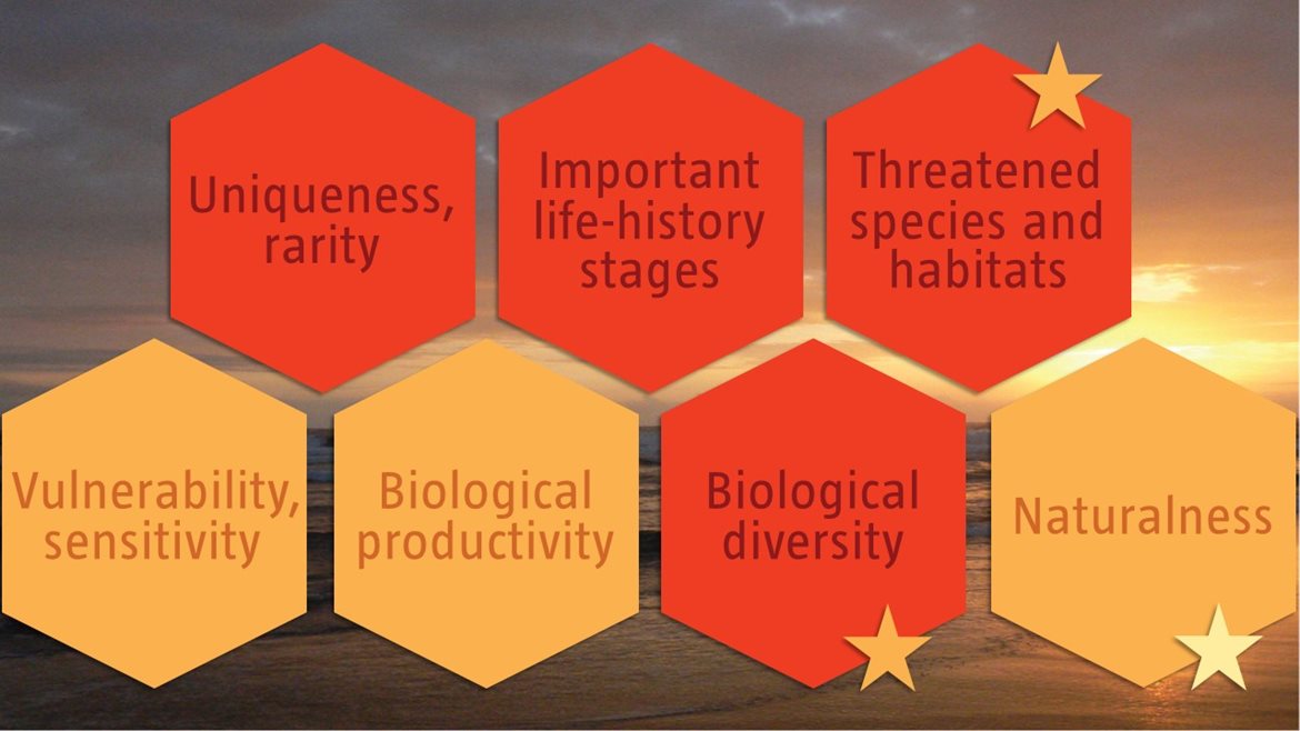
Assessment of the area against CBD EBSA criteria
C1: Uniqueness or rarity High
Justification
This area includes two unique features: a large component of the migratory route of a migratory population of sardines and a unique deep-reef feature that hosts species known only from this location. It is noted that this could be perceived as unique because deep reefs are poorly studied in this region, but no similar bathymetric features have been noted in this depth range in the province (Sink et al., 2011). The migratory route component is a key part of the migration path for several species and is part of a globally unique phenomenon referred to as the “sardine run” (Freon et al., 2010). The term “sardine run” is part of the cultural heritage of the South African nation and refers to a natural phenomenon that involves the coastal, alongshore movement during early austral winter of a small and variable fraction of the South African population of sardine (Sardinops sagax) from the eastern Agulhas Bank to the KwaZulu-Natal (KZN) coast. The sardine run is associated with foraging top predators such as seabirds, mammals (O’Donoghue et al., 2010a, 2010b), sharks and gamefish (Dudley and Cliff 2010, Fennessy et al., 2010) that facilitate its visual detection. This site also contains some endemic seaweed species (De Clerck et al., 2005).
C2: Special importance for life-history stages of species High
Justification
This area includes the Protea Banks, a known spawning aggregation site for several species (Mann 2000) and an area that is part of an important migration path for several species, most notably the “sardine run”. A genetically distinct portion of the South African population of sardine Sardinops sagax migrates through this area as part of a well-known phenomenon that is less well understood from a process perspective (Van der Lingen et al., 2010). The sardines are followed by large numbers of sharks, cetaceans and seabirds. Key species in this migration event include Geelbek (Atractoscion aequidens) and Garrick (Lichia amia), and the area is also important for the endemic and threatened sparid Seventy-four (Polysteganus undulosus) (Mann et al., 2000, Fennessey et al., 2010). This area is considered a nursing ground for the sparid Chrysoblephus puniceus (Ezemvelo KZN Wildlife 2012). BirdLife data indicate that this area is important for foraging white chinned petrels, and the sardine run is a key ecological event providing forage fish for Cape gannets (Freon et al., 2010, O’Donoghue et al., 2010).
C3: Importance for threatened, endangered or declining species and/or habitats High
Justification
This area has some importance for overexploited sparids and sciaenids (Mann 2000) and Vulnerable (IUCN global redlist) seabirds. Overexploited sparid and scienids include Chrysoblephus puniceus (Mann 2000). Cape gannets and white chinned petrels utilise this area (Freon et al., 2010, Birdlife tracking data). The Protea Banks and Sardine Route is also a key component of the regionally Critically Endangered leatherback turtles’ migration route (Harris et al., 2018), with hatchlings of both leatherbacks and (regionally Near Threatened) loggerheads also dispersing through the area. Green turtles and hawksbills are also present on reefs in the area as well, both of which species are also threatened. The 20 threatened ecosystem types within this EBSA include the Endangered: Natal Inner Shelf Reef Sand Mosaic, Natal Mid Shelf Reef Gravel Mosaic, Protea Mid Shelf Reef Complex, Subtropical Large Fluvially Dominated Estuary, Subtropical Large Temporarily Closed Estuary, Subtropical Predominantly Open Estuary, Trafalgar Reef Complex; and the Vulnerable: Agulhas Exposed Rocky Shore, Agulhas Very Exposed Rocky Shore, Aliwal Shoal Reef Complex, Natal Boulder Shore, Natal Mixed Shore, Natal-Delagoa Reflective Sandy Shore, Pondoland Inner Shelf Reef Sand Mosaic (C), Port St Johns Inner Shelf Reef Mosaic (A), Port St Johns Muddy Mid Shelf, Port St Johns Muddy Shelf Edge, Subtropical Small Temporarily Closed Estuary, Warm Temperate Large Temporarily Closed Estuary, and Warm Temperate Predominantly Open Estuary. A further seven ecosystem types are Near Threatened (Sink et al., 2019).
C4: Vulnerability, fragility, sensitivity, or slow recovery Medium
Justification
This area includes submarine canyons, an area of steep shelf edge and a unique deep-reef system. These habitats may support fragile habitat-forming species. Seven records of two species of reef-building coldwater corals (Goniocorella dumosa, Solenosmilia variabilis) have been recorded in the area (Sink et al., 2011) and are in the Iziko South African museum invertebrate collection. In-situ surveys have not been undertaken in this area, and further research is needed to provide more information on habitat sensitivity.
C5: Biological productivity Medium
Justification
This steep area has a relatively high frequency of chlorophyll-a and SST fronts (Lagabrielle 2009, Sink et al., 2012, Roberson et al., 2017). Further, the sardine run phenomenon provides a huge, albeit temporary, increase in productivity.
C6: Biological diversity High
Justification
Sink et al. (2011, 2019) showed high benthic habitat diversity in this area, with 40 ecosystem types represented in a relatively small area. The dynamic pelagic environment and the sardine run also contribute to the high diversity in the pelagic ecosystems (Freon et al., 2010, Van der Lingen et al., 2010).
C7: Naturalness Medium
Justification
Cumulative pressure overall is moderate, with some coastal areas under much higher cumulative pressure (Sink et al., 2019). Consequently, the bulk of the EBSA is in either good (62%) or fair (33%) ecological condition with only 5% in poor ecological condition (Sink et al., 2019). There is no pelagic longlining inshore of 20 nm in this area (Sink et al., 2011).
Other relevant website address or attached documents
Summary of ecosystem types and threat status for the Protea Banks and Sardine Route EBSA. Data from Sink et al. (2019).
|
Threat Status
|
Ecosystem Type
|
Area (km2)
|
Area (%)
|
|
Endangered
|
Natal Inner Shelf Reef Sand Mosaic
|
215.5
|
2.3
|
|
|
Natal Mid Shelf Reef Gravel Mosaic
|
841.1
|
9.0
|
|
|
Protea Mid Shelf Reef Complex
|
15.5
|
0.2
|
|
|
Subtropical Large Fluvially Dominated Estuary
|
1.7
|
0.0
|
|
|
Subtropical Large Temporarily Closed Estuary
|
7.5
|
0.1
|
|
|
Subtropical Predominantly Open Estuary
|
4.2
|
0.0
|
|
|
Trafalgar Reef Complex
|
58.7
|
0.6
|
|
Vulnerable
|
Agulhas Exposed Rocky Shore
|
0.7
|
0.0
|
|
|
Agulhas Very Exposed Rocky Shore
|
0.3
|
0.0
|
|
|
Aliwal Shoal Reef Complex
|
5.2
|
0.1
|
|
|
Natal Boulder Shore
|
0.3
|
0.0
|
|
|
Natal Mixed Shore
|
40.5
|
0.4
|
|
|
Natal-Delagoa Reflective Sandy Shore
|
0.8
|
0.0
|
|
|
Pondoland Inner Shelf Reef Sand Mosaic (C)
|
249.3
|
2.7
|
|
|
Port St Johns Inner Shelf Reef Mosaic (A)
|
48.5
|
0.5
|
|
|
Port St Johns Muddy Mid Shelf
|
124.8
|
1.3
|
|
|
Port St Johns Muddy Shelf Edge
|
129.4
|
1.4
|
|
|
Subtropical Small Temporarily Closed Estuary
|
7.7
|
0.1
|
|
|
Warm Temperate Large Temporarily Closed Estuary
|
0.5
|
0.0
|
|
|
Warm Temperate Predominantly Open Estuary
|
0.2
|
0.0
|
|
Near Threatened
|
Agulhas Dissipative Sandy Shore
|
0.2
|
0.0
|
|
|
Agulhas Mixed Shore
|
2.4
|
0.0
|
|
|
Natal Exposed Rocky Shore
|
28.7
|
0.3
|
|
|
Natal Pondoland Shelf Edge Coarse Sand Reef Mosaic
|
593.9
|
6.4
|
|
|
Natal Very Exposed Rocky Shore
|
1.0
|
0.0
|
|
|
Natal-Delagoa Dissipative Sandy Shore
|
0.7
|
0.0
|
|
|
Natal-Delagoa Intermediate Sandy Shore
|
10.1
|
0.1
|
|
Least Concern
|
Agulhas Dissipative-Intermediate Sandy Shore
|
0.1
|
0.0
|
|
|
Natal Deep Shelf Edge
|
695.6
|
7.4
|
|
|
Natal Pondoland Lower Canyons
|
868.7
|
9.3
|
|
|
Natal Pondoland Upper Canyons
|
83.1
|
0.9
|
|
|
Natal-Delagoa Dissipative-Intermediate Sandy Shore
|
9.2
|
0.1
|
|
|
Pondoland Mid Shelf Coarse Sediment Reef Mosaic(B)
|
676.2
|
7.2
|
|
|
Pondoland Shelf Edge Gravel Reef Mosaic
|
859.1
|
9.2
|
|
|
Southwest Indian Lower Slope
|
384.5
|
4.1
|
|
|
Southwest Indian Mid Slope
|
2234.1
|
23.9
|
|
|
Southwest Indian Upper Slope
|
1146.3
|
12.3
|
|
|
Warm Temperate Small Temporarily Closed
|
0.5
|
<0.1
|
|
N/A
|
Subtropical Micro-estuary
|
1.6
|
<0.1
|
|
|
Warm Temperate Micro-estuary
|
<0.1
|
<0.1
|
|
Grand Total
|
|
9344.7
|
100.0
|
[Top]