 This area extends south, north and offshore of the existing Maputaland and St Lucia marine protected areas in the iSimangaliso Wetland Park, a World Heritage Site, and also encompasses the Ponta do Ouro Partial Marine Reserve, to capture the full extent of offshore benthic and pelagic habitat types, providing for coastal and offshore connectivity and covering the important offshore habitats of endangered Leatherback Turtles. The area includes a key migratory route for humpback whales, a nursery area for bull sharks, spawning areas for fish (endemic sparids) and sharks and includes habitat of other threatened species including coelacanths, marine mammals and sharks. Potential vulnerable marine ecosystems include numerous submarine canyons, paleo shorelines, deep reefs and hard shelf edge with reef-building cold-water corals also recovered at depths of more than 900 m. Whale sharks feed in this area in summer.
[Top]
Open or collapse the legend as a sidebar by clicking the icon in the top left corner of the map. In the legend you can turn on/off the old/new extents of the EBSA. You can zoom in/out using the mouse or the +/- buttons on the map, and click on the features for more information.
[Top]
Delagoa Shelf Edge, Canyons and Slope was not revised because it is a transboundary EBSA shared with Mozambique, which is a country outside of the BCLME and thus the revision was beyond the scope of the MARISMA project. However, because the South African portion of this EBSA was included in the status assessment and management recommendations, the original description is given below.
[Top]
NOTE: Read this here, on the CBD website, or download the Word document on the right sidebar.
General Information
Summary
This area extends south, north and offshore of the existing Maputaland and St Lucia marine protected areas in the iSimangaliso Wetland Park, a World Heritage Site, and also encompasses the Ponta do Ouro Partial Marine Reserve, to capture the full extent of offshore benthic and pelagic habitat types, providing for coastal and offshore connectivity and covering the important offshore habitats of endangered Leatherback Turtles. The area includes a key migratory route for humpback whales, a nursery area for bull sharks, spawning areas for fish (endemic sparids) and sharks and includes habitat of other threatened species including coelacanths, marine mammals and sharks. Potential vulnerable marine ecosystems include numerous submarine canyons, paleo shorelines, deep reefs and hard shelf edge with reef-building cold-water corals also recovered at depths of more than 900 m. Whale sharks feed in this area in summer.
Introduction of the area
This area extends south, north and offshore of the existing Maputaland and St Lucia marine protected areas in the iSimangaliso Wetland Park, a World Heritage Site, and also encompasses the Ponta do Ouro Partial Marine Reserve, to capture the full extent of offshore benthic and pelagic habitat types, providing for coastal and offshore connectivity and covering the important offshore habitats of endangered Leatherback Turtles. The area includes a key migratory route for Humpback Whales, a nursery area for Bull Sharks, spawning areas for fish (especially endemic sparids) and sharks and includes habitat of other threatened species, including coelacanths, marine mammals and sharks. Potential vulnerable marine ecosystems include numerous submarine canyons, palaeo-shorelines and deep reefs, and hard shelf edge with reef-building cold-water corals in depths of more than 900 m. Whale sharks feed in this area in summer. This area has been identified as a priority area by two different systematic biodiversity plans, a national plan to identify focus areas for offshore protection (Sink et al. 2011) and a fine-scale provincial plan for the province of KwaZulu-Natal (Harris et al. 2011).
Description of the location
EBSA Region
Southern Indian Ocean
Description of location
Approximately 26°S to 29°S and 32°E and 34°. This area extends south, north and offshore of the existing Maputaland and St. Lucia marine protected areas in the iSimangaliso Wetland Park.
Geo-Location
SIO_7_EBSA.geojson
Area Details
Feature description of the area
The area meeting EBSA criteria is bounded by the highwater mark of a coastline characterized by the highest vegetated dunes in the world, with minimal terrigenous riverine input (see Sink et al. 2011 and Harris et al. 2011), making the area relatively natural and pristine. The deeper reaches are characterized by bioclastic and siliceous sediments intersected by Pleistocene sandstone reefs formed during changes in sea level. The continental shelf is intersected by canyons and is steep, falling to fine, unconsolidated sediment and is bathed by the warm Agulhas Current, the largest of the western boundary currents.
Feature conditions and future outlook of the proposed area
South Africa’s National Biodiversity Assessment 2011 (Sink et al. 2012) indicated that most of this area was in good condition, but these analyses were confined to South Africa. The area is relatively pristine but emerging pressures include new mining and petroleum applications and a port development in Mozambique. The inshore reaches are subjected to limited fishing and regulated recreational activities.
References
Ezemvelo KZN Wildlife. 2012. Focus areas for additional marine biodiversity protection in KwaZulu-Natal, South Africa. Unpublished Report - Jan 2012. Scientific Services, Ezemvelo KZN Wildlife: Durban. Pp 62.
Harris JM, Livingstone T, Lombard AT, Lagabrielle E, Haupt P, Sink K, Mann B and Schleyer M. 2011 Marine Systematic Conservation Assessment and Plan for KwaZulu-Natal - Spatial priorities for conservation of marine and coastal biodiversity in KwaZulu-Natal. Ezemvelo KZN Wildlife.
Haupt P. 2010. Conservation assessment and plan for fish species along the KwaZulu-Natal coast. MSc Thesis, Nelson Mandela Metropolitan University, South Africa.
Lagabrielle E. 2009. Preliminary report: National Pelagic Bioregionalisation of South Africa. Cape Town: South African National Biodiversity Institute.
Lutjeharms JRE, Gründlingh M and Carter RA. 1989. Topographically induced upwelling in the Natal Bight. South African Journal of Science, 85(5): 310 -316.)
Lutjeharms JRE, Cooper J, Roberts M. 2000.Upwelling at the inshore edge of the Agulhas Current. Continental Shelf Research, 20(7): 737 – 761.
Taylor, F.E., Arnould, M.N., Bester, M.N, Crawford, R.J.M., Bruyn, P.J.N, Delords, K., Makhado, A.B., Ryan, P.G., Tosh, C.A. and Weimerskirchs, H., 2011. The seasonal distribution and habitat use of marine top predators in the Southern Indian Ocean, and implications for conservation.WWF report, South Africa.
Sink KJ, Attwood CG, Lombard AT, Grantham H, Leslie R, Samaai T, Kerwath S, Majiedt P, Fairweather T, Hutchings L, van der Lingen C, Atkinson LJ, Wilkinson S, Holness S, Wolf T. 2011. Spatial planning to identify focus areas for offshore biodiversity protection in South Africa. Unpublished Report. Cape Town: South African National Biodiversity Institute.
Sink K, Holness S, Harris L, Majiedt P, Atkinson L, Robinson T, Kirkman S, Hutchings L, Leslie R, Lamberth S, Kerwath S, von der Heyden S, Lombard A, Attwood C, Branch G, Fairweather T, Taljaard S, Weerts S, Cowley P, Awad A, Halpern B, Grantham H, Wolf T. 2012. National Biodiversity Assessment 2011: Technical Report. Volume 4: Marine and Coastal Component. South African National Biodiversity Institute, Pretoria. Pp 325
Other relevant website address or attached documents
SIO_7_EBSA-GIS shapefile.zip (/api/v2013/documents/A2ECA61B-EE6C-281A-98C4-47404787B99C/attachments/SIO_7_EBSA-GIS%20shapefile.zip)
Status of submission
Areas described as meeting EBSA criteria that were considered by the Conference of the Parties.
COP Decision
dec-COP-12-DEC-22
Assessment of the area against CBD EBSA criteria
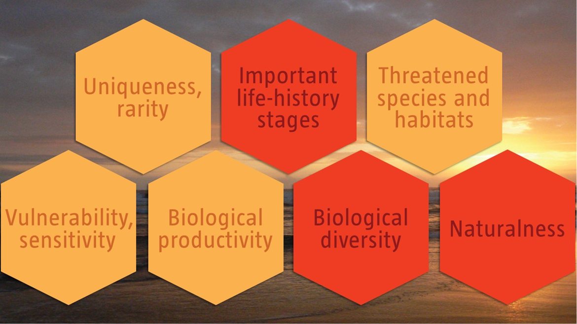
C1: Uniqueness or rarity Medium
Justification
The submarine canyons support a population of coelacanths (Latimeria chalumnae). The spotted legskate (Anacanthobatis marmoratus) is a rare species found in this area (Haupt 2010).
C2: Special importance for life-history stages of species High
Justification
Breeding and feeding areas for leatherback turtles (particularly in the south). Migratory corridor for humpback whales. Nursery area for bull shark (Carcharhinus leucas). Spawning area for dusky shark (Carcharhinus obscurus) and King Mackerel (Scomber japonicas). Spawning and nursery area for sand tiger shark (Carcharias taurus) (Sink et al. 2011, Vogt 2011, Ezemvelo KZNW Wildlife 2012).
C3: Importance for threatened, endangered or declining species and/or habitats Medium
Justification
IUCN listed species: CR: Ceolacanth – Latimeria chalumnae EN: Scalloped hammerhead – Sphyrna lewini (EN), great hammerhead - S. mokarran VU: Sperm whales – Physeter macrocephalus , smooth hammerhead – Sphyrna zygaena Overexploited linefish species (sarids, sciaenids).
C4: Vulnerability, fragility, sensitivity, or slow recovery Medium
Justification
Two species of reef-forming cold-water corals. Numerous submarine canyons. Important for vulnerable shark species with low fecundity.
C5: Biological productivity Medium
Justification
Chlorophyll-a and sea temperature fronts contribute to variable and elevated productivity in this area (Ezemvelo KZN Wildlife 2012).
C6: Biological diversity High
Justification
This area includes the overlap between the Delagoa and Natal ecoregions and is considered an important transition zone (Sink et al. 2011, 2012, Ezemvelo KZN Wildlife 2012. High habitat heterogeneity and high species diversity are reported.
C7: Naturalness High
Justification
This area is relatively pristine with almost no industrial fishing (pelagic long lining not permitted within 20nm of the coast).
[Top]